Simbach am Inn geodata
Simbach am Inn (Bavaria) is a populated place; located in Germany in Europe/Berlin (GMT+2) time zone. With population of 9,979 people, there are 1639 cities with bigger population in this country. Compared to other cities in Germany, 91.7% of cities are located further ↑North; 92.5% of cities are located further ←West and 69.5% of cities have lower elevation than Simbach am Inn. Note1
Administrative division(s):
- Level 1: Bavaria
- Level 2: Lower Bavaria
- Level 3: Landkreis Rottal-Inn
- Level 4: Simbach a.Inn


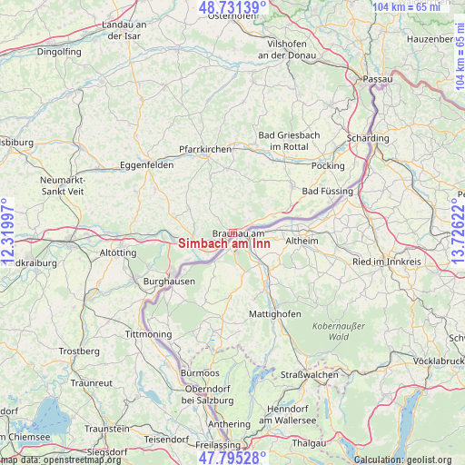
Simbach am Inn GPS coordinates[2]
48° 15' 55.728" North, 13° 1' 23.124" East
| Map corner | latitude | longitude |
|---|---|---|
| Upper-left | 48.73139°, | 12.31997° |
| Center: | 48.26548°, | 13.02309° |
| Lower-right: | 47.79528°, | 13.72622° |
| Map W x H: | 104.1×104.1 km | = 64.7×64.7mi |
| max Lat: | 55.01917° ⇑91.7% North |
| Simbach am Inn: | 48.26548° |
| min Lat: | ⇓8.3% South 47.40724° |
| min Long | Simbach am Inn | max Long |
| 5.92978° | 13.02309° | 14.98853° |
| W 92.5%⇐ | ⇒7.5% E |
Elevation
Elevation of Simbach am Inn is 355 m = 1165 ft, and this is 105.9 m = 347 ft above average elevation for this country.
| Max E: |
1256 m = 4121 ft | 30.5% |
| Simbach am Inn | 355 m 1165 ft | |
| Avg. | 249.1 m = 817 ft | |
Min E: |
-5 m = -16 ft | 69.5% |
See also: Germany elevation on elevation.city.
Geographical zone
Simbach am Inn is located in North temperate zone (between Tropic of Cancer and the Arctic Circle). Distance of this North polar circle is 2034.6 km =1264.2 mi to North.| Distance of | km | miles | from Simbach am Inn |
|---|---|---|---|
| North Pole | 4640.4 | 2883.4 | to North |
| Arctic Circle | 2034.6 | 1264.2 | to North |
| Tropic Cancer | 2760.7 | 1715.4 | to South |
| Equator | 5366.6 | 3334.6 | to South |


Nearby cities:
15 places around Simbach am Inn: (largest is in red/bold)
• Chostlarn
13.8 km =8.6 mi,  31°
31°
• Ering
10.1 km =6.3 mi,  68°
68°
• Haiming
10.6 km =6.6 mi,  239°
239°
• Julbach
5 km =3.1 mi,  255°
255°
• Kirchdorf am Inn
3.5 km =2.2 mi, 235°
• Malching
13.2 km =8.2 mi, 66°
• Marktl
13.3 km =8.3 mi,  265°
265°
• Reut
8.7 km =5.4 mi,  310°
310°
• Rotthalmünster
16.8 km =10.4 mi,  51°
51°
• Stammham
10.5 km =6.5 mi, 260°
• Stubenberg
7.2 km =4.5 mi,  38°
38°
• Tann
11.1 km =6.9 mi,  299°
299°
• Triftern
14.4 km =8.9 mi,  355°
355°
• Wittibreut
7.6 km =4.7 mi,  339°
339°
• Zeilarn
13.9 km =8.6 mi,  286°
286°
Sources, notices
• [Note1] Compared only with cities in Germany existing in our database
• [Src1] Map data: © OpenStreetMap contributors (CC-BY-SA)
• [Src2] Other city data from geonames.org with taken over terms of usage.
• [Src3] Geographical zone / Annual Mean Temperature by Robert A. Rohde @ Wikipedia
