Stolpe geodata
Stolpe (Schleswig-Holstein) is a seat of a fourth-order administrative division; located in Germany in Europe/Berlin (GMT+2) time zone. With population of 1,322 people, there are 6245 cities with bigger population in this country. Compared to other cities in Germany, 94.2% of cities are located further ↓South; 53.6% of cities are located further ←West and 77.9% of cities have higher elevation than Stolpe. Note1


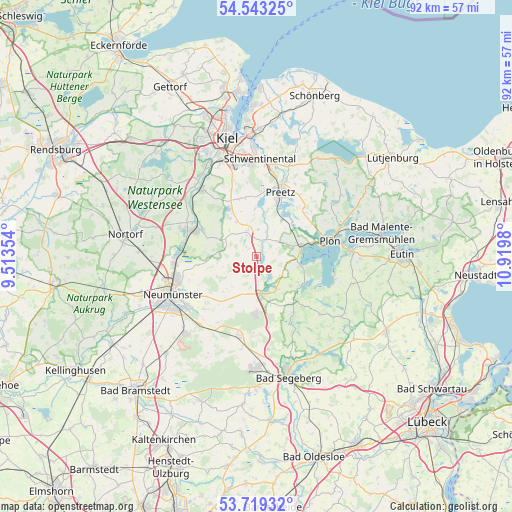
Stolpe GPS coordinates[2]
54° 7' 59.988" North, 10° 13' 0.012" East
| Map corner | latitude | longitude |
|---|---|---|
| Upper-left | 54.54325°, | 9.51354° |
| Center: | 54.13333°, | 10.21667° |
| Lower-right: | 53.71932°, | 10.9198° |
| Map W x H: | 91.6×91.6 km | = 56.9×56.9mi |
| max Lat: | 55.01917° ⇑5.8% North |
| Stolpe: | 54.13333° |
| min Lat: | ⇓94.2% South 47.40724° |
| min Long | Stolpe | max Long |
| 5.92978° | 10.21667° | 14.98853° |
| W 53.6%⇐ | ⇒46.4% E |
Elevation
Elevation of Stolpe is 53 m = 174 ft, and this is 196.1 m = 643 ft below average elevation for this country.
| Max E: |
1256 m = 4121 ft | 77.9% |
| Avg. | 249.1 m = 817 ft | |
| Stolpe | 53 m = 174 ft | |
Min E: |
-5 m = -16 ft | 22.1% |
See also: Germany elevation on elevation.city.
Geographical zone
Stolpe is located in North temperate zone (between Tropic of Cancer and the Arctic Circle). Distance of this North polar circle is 1382.1 km =858.8 mi to North.| Distance of | km | miles | from Stolpe |
|---|---|---|---|
| North Pole | 3988 | 2478 | to North |
| Arctic Circle | 1382.1 | 858.8 | to North |
| Tropic Cancer | 3413.1 | 2120.8 | to South |
| Equator | 6019.1 | 3740.1 | to South |


Nearby cities:
15 places around Stolpe: (largest is in red/bold)
• Barmissen
7.7 km =4.8 mi,  343°
343°
• Belau
4.8 km =3 mi,  145°
145°
• Bornhöved
7.5 km =4.7 mi,  171°
171°
• Dersau
7.8 km =4.8 mi,  102°
102°
• Kalübbe
4.7 km =2.9 mi,  113°
113°
• Kühren
7.8 km =4.8 mi,  20°
20°
• Löptin
5.6 km =3.5 mi,  0°
0°
• Nettelsee
5 km =3.1 mi, 341°
• Rendswühren
6 km =3.7 mi,  201°
201°
• Ruhwinkel
3.7 km =2.3 mi,  180°
180°
• Schillsdorf
5.7 km =3.5 mi,  251°
251°
• Schmalensee
6.6 km =4.1 mi, 147°
• Wahlstorf (Dorf)
7.1 km =4.4 mi,  45°
45°
• Wankendorf
2.5 km =1.6 mi, 197°
• Warnau
6.4 km =4 mi,  329°
329°
Sources, notices
• [Note1] Compared only with cities in Germany existing in our database
• [Src1] Map data: © OpenStreetMap contributors (CC-BY-SA)
• [Src2] Other city data from geonames.org with taken over terms of usage.
• [Src3] Geographical zone / Annual Mean Temperature by Robert A. Rohde @ Wikipedia
