Unterschönau geodata
Unterschönau (Thuringia) is a seat of a fourth-order administrative division; located in Germany in Europe/Berlin (GMT+2) time zone. With population of 626 people, there are 8680 cities with bigger population in this country. Compared to other cities in Germany, 52.5% of cities are located further ↓South; 60.4% of cities are located further ←West and 89.7% of cities have lower elevation than Unterschönau. Note1
Administrative division(s):
- Level 1: Thuringia
- Level 3: Landkreis Schmalkalden-Meiningen
- Level 4: Steinbach-Hallenberg, Kurort


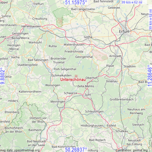
Unterschönau GPS coordinates[2]
50° 43' 0.012" North, 10° 34' 59.988" East
| Map corner | latitude | longitude |
|---|---|---|
| Upper-left | 51.15975°, | 9.8802° |
| Center: | 50.71667°, | 10.58333° |
| Lower-right: | 50.26937°, | 11.28646° |
| Map W x H: | 99×99 km | = 61.5×61.5mi |
| max Lat: | 55.01917° ⇑47.5% North |
| Unterschönau: | 50.71667° |
| min Lat: | ⇓52.5% South 47.40724° |
| min Long | Unterschönau | max Long |
| 5.92978° | 10.58333° | 14.98853° |
| W 60.4%⇐ | ⇒39.6% E |
Elevation
Elevation of Unterschönau is 510 m = 1673 ft, and this is 260.9 m = 856 ft above average elevation for this country.
| Max E: |
1256 m = 4121 ft | 10.3% |
| Unterschönau | 510 m 1673 ft | |
| Avg. | 249.1 m = 817 ft | |
Min E: |
-5 m = -16 ft | 89.7% |
See also: Germany elevation on elevation.city.
Geographical zone
Unterschönau is located in North temperate zone (between Tropic of Cancer and the Arctic Circle). Distance of this North polar circle is 1762 km =1094.9 mi to North.| Distance of | km | miles | from Unterschönau |
|---|---|---|---|
| North Pole | 4367.9 | 2714.1 | to North |
| Arctic Circle | 1762 | 1094.9 | to North |
| Tropic Cancer | 3033.2 | 1884.7 | to South |
| Equator | 5639.2 | 3504 | to South |


Nearby cities:
15 places around Unterschönau: (largest is in red/bold)
• Altersbach
4 km =2.5 mi,  242°
242°
• Benshausen
7.5 km =4.7 mi,  170°
170°
• Bermbach
4.4 km =2.7 mi, 168°
• Breitenbach
7.2 km =4.5 mi, 244°
• Christes
9 km =5.6 mi,  231°
231°
• Oberhof
10.2 km =6.3 mi,  97°
97°
• Oberschönau
2.3 km =1.4 mi,  90°
90°
• Rotterode
2.1 km =1.3 mi,  256°
256°
• Schmalkalden
9.8 km =6.1 mi,  273°
273°
• Schwarza
11.5 km =7.1 mi,  199°
199°
• Springstille
5.1 km =3.2 mi, 229°
• Steinbach-Hallenberg
2.6 km =1.6 mi,  209°
209°
• Tambach-Dietharz
8.7 km =5.4 mi,  15°
15°
• Viernau
6.3 km =3.9 mi, 196°
• Zella-Mehlis
8.6 km =5.3 mi,  140°
140°
Sources, notices
• [Note1] Compared only with cities in Germany existing in our database
• [Src1] Map data: © OpenStreetMap contributors (CC-BY-SA)
• [Src2] Other city data from geonames.org with taken over terms of usage.
• [Src3] Geographical zone / Annual Mean Temperature by Robert A. Rohde @ Wikipedia
