Stamsried geodata
Stamsried (Bavaria) is a populated place; located in Germany in Europe/Berlin (GMT+2) time zone. With population of 2,276 people, there are 4708 cities with bigger population in this country. Compared to other cities in Germany, 79.2% of cities are located further ↑North; 88.2% of cities are located further ←West and 83.1% of cities have lower elevation than Stamsried. Note1
Administrative division(s):
- Level 1: Bavaria
- Level 2: Upper Palatinate
- Level 3: Landkreis Cham
- Level 4: Stamsried, Markt


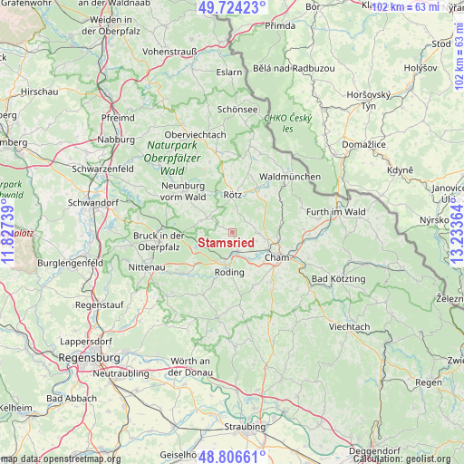
Stamsried GPS coordinates[2]
49° 16' 3.18" North, 12° 31' 49.836" East
| Map corner | latitude | longitude |
|---|---|---|
| Upper-left | 49.72423°, | 11.82739° |
| Center: | 49.26755°, | 12.53051° |
| Lower-right: | 48.80661°, | 13.23364° |
| Map W x H: | 102×102 km | = 63.4×63.4mi |
| max Lat: | 55.01917° ⇑79.2% North |
| Stamsried: | 49.26755° |
| min Lat: | ⇓20.8% South 47.40724° |
| min Long | Stamsried | max Long |
| 5.92978° | 12.53051° | 14.98853° |
| W 88.2%⇐ | ⇒11.8% E |
Elevation
Elevation of Stamsried is 454 m = 1490 ft, and this is 204.9 m = 672 ft above average elevation for this country.
| Max E: |
1256 m = 4121 ft | 16.9% |
| Stamsried | 454 m 1490 ft | |
| Avg. | 249.1 m = 817 ft | |
Min E: |
-5 m = -16 ft | 83.1% |
See also: Germany elevation on elevation.city.
Geographical zone
Stamsried is located in North temperate zone (between Tropic of Cancer and the Arctic Circle). Distance of this North polar circle is 1923.1 km =1195 mi to North.| Distance of | km | miles | from Stamsried |
|---|---|---|---|
| North Pole | 4529 | 2814.2 | to North |
| Arctic Circle | 1923.1 | 1195 | to North |
| Tropic Cancer | 2872.1 | 1784.6 | to South |
| Equator | 5478 | 3403.9 | to South |


Nearby cities:
15 places around Stamsried: (largest is in red/bold)
• Cham
10.2 km =6.3 mi,  117°
117°
• Gleißenberg
15.7 km =9.8 mi,  69°
69°
• Neukirchen-Balbini
7.3 km =4.5 mi,  290°
290°
• Neunburg vorm Wald
13.8 km =8.6 mi,  310°
310°
• Pemfling
6.3 km =3.9 mi,  90°
90°
• Pösing
4.1 km =2.5 mi,  159°
159°
• Roding
8.2 km =5.1 mi,  185°
185°
• Rötz
8.4 km =5.2 mi,  359°
359°
• Schorndorf
12.8 km =8 mi, 159°
• Schönthal
10.5 km =6.5 mi,  28°
28°
• Thanstein
13.7 km =8.5 mi,  340°
340°
• Traitsching
15.7 km =9.8 mi,  146°
146°
• Waffenbrunn
9.9 km =6.2 mi, 90°
• Walderbach
14.2 km =8.8 mi,  228°
228°
• Willmering
10.1 km =6.3 mi,  101°
101°
Sources, notices
• [Note1] Compared only with cities in Germany existing in our database
• [Src1] Map data: © OpenStreetMap contributors (CC-BY-SA)
• [Src2] Other city data from geonames.org with taken over terms of usage.
• [Src3] Geographical zone / Annual Mean Temperature by Robert A. Rohde @ Wikipedia
