Stammham geodata
Stammham (Bavaria) is a seat of a fourth-order administrative division; located in Germany in Europe/Berlin (GMT+2) time zone. In our database, there are 11009 cities with bigger population. Compared to other cities in Germany, 84.6% of cities are located further ↑North; 73.5% of cities are located further ←West and 85.6% of cities have lower elevation than Stammham. Note1
Administrative division(s):
- Level 1: Bavaria
- Level 2: Upper Bavaria
- Level 3: Landkreis Eichstätt
- Level 4: Stammham


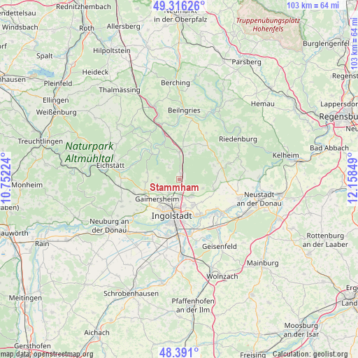
Stammham GPS coordinates[2]
48° 51' 20.772" North, 11° 27' 19.296" East
| Map corner | latitude | longitude |
|---|---|---|
| Upper-left | 49.31626°, | 10.75224° |
| Center: | 48.85577°, | 11.45536° |
| Lower-right: | 48.391°, | 12.15849° |
| Map W x H: | 102.9×102.9 km | = 63.9×63.9mi |
| max Lat: | 55.01917° ⇑84.6% North |
| Stammham: | 48.85577° |
| min Lat: | ⇓15.4% South 47.40724° |
| min Long | Stammham | max Long |
| 5.92978° | 11.45536° | 14.98853° |
| W 73.5%⇐ | ⇒26.5% E |
Elevation
Elevation of Stammham is 474 m = 1555 ft, and this is 224.9 m = 738 ft above average elevation for this country.
| Max E: |
1256 m = 4121 ft | 14.4% |
| Stammham | 474 m 1555 ft | |
| Avg. | 249.1 m = 817 ft | |
Min E: |
-5 m = -16 ft | 85.6% |
See also: Germany elevation on elevation.city.
Geographical zone
Stammham is located in North temperate zone (between Tropic of Cancer and the Arctic Circle). Distance of this North polar circle is 1968.9 km =1223.4 mi to North.| Distance of | km | miles | from Stammham |
|---|---|---|---|
| North Pole | 4574.8 | 2842.6 | to North |
| Arctic Circle | 1968.9 | 1223.4 | to North |
| Tropic Cancer | 2826.3 | 1756.2 | to South |
| Equator | 5432.3 | 3375.5 | to South |


Nearby cities:
15 places around Stammham: (largest is in red/bold)
• Buxheim
13.1 km =8.1 mi,  245°
245°
• Böhmfeld
6.4 km =4 mi,  274°
274°
• Denkendorf
8.1 km =5 mi,  0°
0°
• Eitensheim
11 km =6.8 mi, 246°
• Gaimersheim
8.4 km =5.2 mi,  229°
229°
• Großmehring
11.4 km =7.1 mi,  150°
150°
• Hepberg
3.7 km =2.3 mi,  172°
172°
• Hitzhofen
10.2 km =6.3 mi, 266°
• Ingolstadt
10.3 km =6.4 mi,  192°
192°
• Lenting
5.1 km =3.2 mi,  177°
177°
• Mindelstetten
14.3 km =8.9 mi,  92°
92°
• Oberdolling
10.5 km =6.5 mi,  106°
106°
• Vohburg an der Donau
15.3 km =9.5 mi,  128°
128°
• Walting
13.2 km =8.2 mi,  300°
300°
• Wettstetten
4.8 km =3 mi,  219°
219°
Sources, notices
• [Note1] Compared only with cities in Germany existing in our database
• [Src1] Map data: © OpenStreetMap contributors (CC-BY-SA)
• [Src2] Other city data from geonames.org with taken over terms of usage.
• [Src3] Geographical zone / Annual Mean Temperature by Robert A. Rohde @ Wikipedia
