Hepberg geodata
Hepberg (Bavaria) is a seat of a fourth-order administrative division; located in Germany in Europe/Berlin (GMT+2) time zone. In our database, there are 11009 cities with bigger population. Compared to other cities in Germany, 85.1% of cities are located further ↑North; 73.6% of cities are located further ←West and 80.7% of cities have lower elevation than Hepberg. Note1
Administrative division(s):
- Level 1: Bavaria
- Level 2: Upper Bavaria
- Level 3: Landkreis Eichstätt
- Level 4: Hepberg


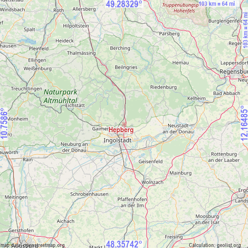
Hepberg GPS coordinates[2]
48° 49' 20.964" North, 11° 27' 42.192" East
| Map corner | latitude | longitude |
|---|---|---|
| Upper-left | 49.28329°, | 10.7586° |
| Center: | 48.82249°, | 11.46172° |
| Lower-right: | 48.35742°, | 12.16485° |
| Map W x H: | 102.9×102.9 km | = 63.9×63.9mi |
| max Lat: | 55.01917° ⇑85.1% North |
| Hepberg: | 48.82249° |
| min Lat: | ⇓14.9% South 47.40724° |
| min Long | Hepberg | max Long |
| 5.92978° | 11.46172° | 14.98853° |
| W 73.6%⇐ | ⇒26.4% E |
Elevation
Elevation of Hepberg is 437 m = 1434 ft, and this is 187.9 m = 616 ft above average elevation for this country.
| Max E: |
1256 m = 4121 ft | 19.3% |
| Hepberg | 437 m 1434 ft | |
| Avg. | 249.1 m = 817 ft | |
Min E: |
-5 m = -16 ft | 80.7% |
See also: Germany elevation on elevation.city.
Geographical zone
Hepberg is located in North temperate zone (between Tropic of Cancer and the Arctic Circle). Distance of this North polar circle is 1972.6 km =1225.7 mi to North.| Distance of | km | miles | from Hepberg |
|---|---|---|---|
| North Pole | 4578.5 | 2844.9 | to North |
| Arctic Circle | 1972.6 | 1225.7 | to North |
| Tropic Cancer | 2822.6 | 1753.9 | to South |
| Equator | 5428.6 | 3373.2 | to South |


Nearby cities:
15 places around Hepberg: (largest is in red/bold)
• Buxheim
12.5 km =7.8 mi,  262°
262°
• Böhmfeld
8.1 km =5 mi,  301°
301°
• Denkendorf
11.8 km =7.3 mi,  358°
358°
• Eitensheim
10.6 km =6.6 mi,  266°
266°
• Ernsgaden
13.3 km =8.3 mi,  138°
138°
• Gaimersheim
7.1 km =4.4 mi, 255°
• Großmehring
8.1 km =5 mi, 139°
• Hitzhofen
11 km =6.8 mi,  286°
286°
• Ingolstadt
7 km =4.3 mi,  203°
203°
• Lenting
1.4 km =0.9 mi,  189°
189°
• Manching
12 km =7.5 mi,  168°
168°
• Oberdolling
9.7 km =6 mi,  85°
85°
• Stammham
3.7 km =2.3 mi,  352°
352°
• Vohburg an der Donau
12.9 km =8 mi,  117°
117°
• Wettstetten
3.5 km =2.2 mi, 270°
Sources, notices
• [Note1] Compared only with cities in Germany existing in our database
• [Src1] Map data: © OpenStreetMap contributors (CC-BY-SA)
• [Src2] Other city data from geonames.org with taken over terms of usage.
• [Src3] Geographical zone / Annual Mean Temperature by Robert A. Rohde @ Wikipedia
