Ingolstadt geodata
Ingolstadt (Bavaria) is a seat of a third-order administrative division; located in Germany in Europe/Berlin (GMT+2) time zone. With population of 120,658 people, there are 73 cities with bigger population in this country. Compared to other cities in Germany, 85.8% of cities are located further ↑North; 73% of cities are located further ←West and 72.6% of cities have lower elevation than Ingolstadt. Note1
Administrative division(s):
- Level 1: Bavaria
- Level 2: Upper Bavaria
- Level 3: Kreisfreie Stadt Ingolstadt
- Level 4: Ingolstadt


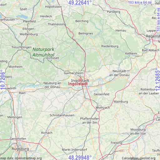
Ingolstadt GPS coordinates[2]
48° 45' 54.288" North, 11° 25' 25.392" East
| Map corner | latitude | longitude |
|---|---|---|
| Upper-left | 49.22641°, | 10.7206° |
| Center: | 48.76508°, | 11.42372° |
| Lower-right: | 48.29948°, | 12.12685° |
| Map W x H: | 103.1×103.1 km | = 64.1×64.1mi |
| max Lat: | 55.01917° ⇑85.8% North |
| Ingolstadt: | 48.76508° |
| min Lat: | ⇓14.2% South 47.40724° |
| min Long | Ingolstadt | max Long |
| 5.92978° | 11.42372° | 14.98853° |
| W 73%⇐ | ⇒27% E |
Elevation
Elevation of Ingolstadt is 379 m = 1243 ft, and this is 129.9 m = 426 ft above average elevation for this country.
| Max E: |
1256 m = 4121 ft | 27.4% |
| Ingolstadt | 379 m 1243 ft | |
| Avg. | 249.1 m = 817 ft | |
Min E: |
-5 m = -16 ft | 72.6% |
See also: Ingolstadt elevation on elevation.city.
Geographical zone
Ingolstadt is located in North temperate zone (between Tropic of Cancer and the Arctic Circle). Distance of this North polar circle is 1979 km =1229.7 mi to North.| Distance of | km | miles | from Ingolstadt |
|---|---|---|---|
| North Pole | 4584.9 | 2848.9 | to North |
| Arctic Circle | 1979 | 1229.7 | to North |
| Tropic Cancer | 2816.2 | 1749.9 | to South |
| Equator | 5422.2 | 3369.2 | to South |


Nearby cities:
15 places around Ingolstadt: (largest is in red/bold)
• Baar-Ebenhausen
11 km =6.8 mi,  162°
162°
• Bergheim
12.2 km =7.6 mi,  267°
267°
• Buxheim
10.7 km =6.6 mi,  295°
295°
• Böhmfeld
11.4 km =7.1 mi,  339°
339°
• Eitensheim
9.7 km =6 mi,  306°
306°
• Ernsgaden
12.2 km =7.6 mi,  106°
106°
• Gaimersheim
6.2 km =3.9 mi,  318°
318°
• Großmehring
8 km =5 mi,  88°
88°
• Hepberg
7 km =4.3 mi,  23°
23°
• Karlskron
9.1 km =5.7 mi,  183°
183°
• Lenting
5.6 km =3.5 mi,  26°
26°
• Manching
7.5 km =4.7 mi,  136°
136°
• Stammham
10.3 km =6.4 mi,  12°
12°
• Weichering
9.2 km =5.7 mi,  234°
234°
• Wettstetten
6.4 km =4 mi,  353°
353°
Sources, notices
• [Note1] Compared only with cities in Germany existing in our database
• [Src1] Map data: © OpenStreetMap contributors (CC-BY-SA)
• [Src2] Other city data from geonames.org with taken over terms of usage.
• [Src3] Geographical zone / Annual Mean Temperature by Robert A. Rohde @ Wikipedia
