Lenting geodata
Lenting (Bavaria) is a seat of a fourth-order administrative division; located in Germany in Europe/Berlin (GMT+2) time zone. In our database, there are 11009 cities with bigger population. Compared to other cities in Germany, 85.2% of cities are located further ↑North; 73.6% of cities are located further ←West and 75.6% of cities have lower elevation than Lenting. Note1
Administrative division(s):
- Level 1: Bavaria
- Level 2: Upper Bavaria
- Level 3: Landkreis Eichstätt
- Level 4: Lenting


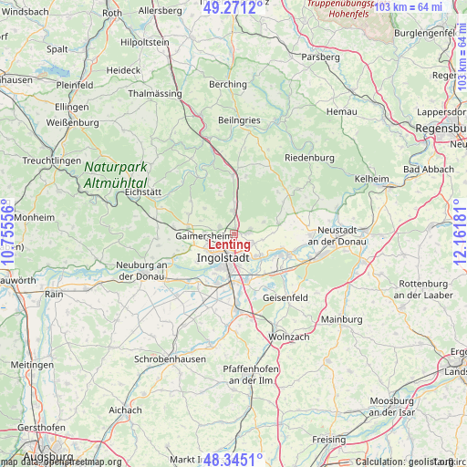
Lenting GPS coordinates[2]
48° 48' 37.044" North, 11° 27' 31.248" East
| Map corner | latitude | longitude |
|---|---|---|
| Upper-left | 49.2712°, | 10.75556° |
| Center: | 48.81029°, | 11.45868° |
| Lower-right: | 48.3451°, | 12.16181° |
| Map W x H: | 103×103 km | = 64×64mi |
| max Lat: | 55.01917° ⇑85.2% North |
| Lenting: | 48.81029° |
| min Lat: | ⇓14.8% South 47.40724° |
| min Long | Lenting | max Long |
| 5.92978° | 11.45868° | 14.98853° |
| W 73.6%⇐ | ⇒26.4% E |
Elevation
Elevation of Lenting is 402 m = 1319 ft, and this is 152.9 m = 502 ft above average elevation for this country.
| Max E: |
1256 m = 4121 ft | 24.4% |
| Lenting | 402 m 1319 ft | |
| Avg. | 249.1 m = 817 ft | |
Min E: |
-5 m = -16 ft | 75.6% |
See also: Germany elevation on elevation.city.
Geographical zone
Lenting is located in North temperate zone (between Tropic of Cancer and the Arctic Circle). Distance of this North polar circle is 1974 km =1226.6 mi to North.| Distance of | km | miles | from Lenting |
|---|---|---|---|
| North Pole | 4579.9 | 2845.8 | to North |
| Arctic Circle | 1974 | 1226.6 | to North |
| Tropic Cancer | 2821.3 | 1753.1 | to South |
| Equator | 5427.2 | 3372.3 | to South |


Nearby cities:
15 places around Lenting: (largest is in red/bold)
• Buxheim
12.2 km =7.6 mi,  268°
268°
• Böhmfeld
8.7 km =5.4 mi,  310°
310°
• Denkendorf
13.1 km =8.1 mi,  359°
359°
• Eitensheim
10.4 km =6.5 mi, 273°
• Ernsgaden
12.5 km =7.8 mi,  133°
133°
• Gaimersheim
6.6 km =4.1 mi, 266°
• Großmehring
7.3 km =4.5 mi, 131°
• Hepberg
1.4 km =0.9 mi,  9°
9°
• Hitzhofen
11.3 km =7 mi,  293°
293°
• Ingolstadt
5.6 km =3.5 mi,  206°
206°
• Manching
10.7 km =6.6 mi,  166°
166°
• Oberdolling
10.1 km =6.3 mi,  77°
77°
• Stammham
5.1 km =3.2 mi, 357°
• Vohburg an der Donau
12.5 km =7.8 mi,  111°
111°
• Wettstetten
3.5 km =2.2 mi, 292°
Sources, notices
• [Note1] Compared only with cities in Germany existing in our database
• [Src1] Map data: © OpenStreetMap contributors (CC-BY-SA)
• [Src2] Other city data from geonames.org with taken over terms of usage.
• [Src3] Geographical zone / Annual Mean Temperature by Robert A. Rohde @ Wikipedia
