Stammbach geodata
Stammbach (Bavaria) is a populated place; located in Germany in Europe/Berlin (GMT+2) time zone. With population of 2,623 people, there are 4310 cities with bigger population in this country. Compared to other cities in Germany, 60.3% of cities are located further ↑North; 77.1% of cities are located further ←West and 92.5% of cities have lower elevation than Stammbach. Note1
Administrative division(s):
- Level 1: Bavaria
- Level 2: Upper Franconia
- Level 3: Landkreis Hof
- Level 4: Stammbach, Markt


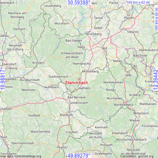
Stammbach GPS coordinates[2]
50° 8' 43.836" North, 11° 41' 28.644" East
| Map corner | latitude | longitude |
|---|---|---|
| Upper-left | 50.59398°, | 10.98817° |
| Center: | 50.14551°, | 11.69129° |
| Lower-right: | 49.69279°, | 12.39442° |
| Map W x H: | 100.2×100.2 km | = 62.3×62.3mi |
| max Lat: | 55.01917° ⇑60.3% North |
| Stammbach: | 50.14551° |
| min Lat: | ⇓39.7% South 47.40724° |
| min Long | Stammbach | max Long |
| 5.92978° | 11.69129° | 14.98853° |
| W 77.1%⇐ | ⇒22.9% E |
Elevation
Elevation of Stammbach is 550 m = 1804 ft, and this is 300.9 m = 987 ft above average elevation for this country.
| Max E: |
1256 m = 4121 ft | 7.5% |
| Stammbach | 550 m 1804 ft | |
| Avg. | 249.1 m = 817 ft | |
Min E: |
-5 m = -16 ft | 92.5% |
See also: Germany elevation on elevation.city.
Geographical zone
Stammbach is located in North temperate zone (between Tropic of Cancer and the Arctic Circle). Distance of this North polar circle is 1825.5 km =1134.3 mi to North.| Distance of | km | miles | from Stammbach |
|---|---|---|---|
| North Pole | 4431.4 | 2753.5 | to North |
| Arctic Circle | 1825.5 | 1134.3 | to North |
| Tropic Cancer | 2969.7 | 1845.3 | to South |
| Equator | 5575.7 | 3464.6 | to South |


Nearby cities:
15 places around Stammbach: (largest is in red/bold)
• Gefrees
6.5 km =4 mi,  149°
149°
• Grafengehaig
9.5 km =5.9 mi,  312°
312°
• Guttenberg
9.1 km =5.7 mi,  276°
276°
• Helmbrechts
10.2 km =6.3 mi,  9°
9°
• Himmelkron
10.9 km =6.8 mi,  216°
216°
• Kupferberg
8.1 km =5 mi,  265°
265°
• Ludwigschorgast
9.6 km =6 mi,  257°
257°
• Marktleugast
5.1 km =3.2 mi, 306°
• Marktschorgast
6.2 km =3.9 mi,  204°
204°
• Münchberg
8.5 km =5.3 mi,  54°
54°
• Neuenmarkt
9.9 km =6.2 mi,  233°
233°
• Oberhaid
8.4 km =5.2 mi,  104°
104°
• Steinbach
3 km =1.9 mi,  286°
286°
• Wirsberg
7.6 km =4.7 mi, 234°
• Zell im Fichtelgebirge
9.4 km =5.8 mi, 96°
Sources, notices
• [Note1] Compared only with cities in Germany existing in our database
• [Src1] Map data: © OpenStreetMap contributors (CC-BY-SA)
• [Src2] Other city data from geonames.org with taken over terms of usage.
• [Src3] Geographical zone / Annual Mean Temperature by Robert A. Rohde @ Wikipedia
