Münchberg geodata
Münchberg (Bavaria) is a populated place; located in Germany in Europe/Berlin (GMT+2) time zone. With population of 11,557 people, there are 1425 cities with bigger population in this country. Compared to other cities in Germany, 59.2% of cities are located further ↑North; 78.7% of cities are located further ←West and 91.6% of cities have lower elevation than Münchberg. Note1
Administrative division(s):
- Level 1: Bavaria
- Level 2: Upper Franconia
- Level 3: Landkreis Hof
- Level 4: Münchberg


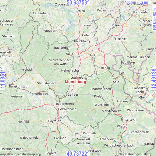
Münchberg GPS coordinates[2]
50° 11' 22.272" North, 11° 47' 17.628" East
| Map corner | latitude | longitude |
|---|---|---|
| Upper-left | 50.63758°, | 11.08511° |
| Center: | 50.18952°, | 11.78823° |
| Lower-right: | 49.73722°, | 12.49136° |
| Map W x H: | 100.1×100.1 km | = 62.2×62.2mi |
| max Lat: | 55.01917° ⇑59.2% North |
| Münchberg: | 50.18952° |
| min Lat: | ⇓40.8% South 47.40724° |
| min Long | Münchberg | max Long |
| 5.92978° | 11.78823° | 14.98853° |
| W 78.7%⇐ | ⇒21.3% E |
Elevation
Elevation of Münchberg is 536 m = 1759 ft, and this is 286.9 m = 941 ft above average elevation for this country.
| Max E: |
1256 m = 4121 ft | 8.4% |
| Münchberg | 536 m 1759 ft | |
| Avg. | 249.1 m = 817 ft | |
Min E: |
-5 m = -16 ft | 91.6% |
See also: Germany elevation on elevation.city.
Geographical zone
Münchberg is located in North temperate zone (between Tropic of Cancer and the Arctic Circle). Distance of this North polar circle is 1820.6 km =1131.3 mi to North.| Distance of | km | miles | from Münchberg |
|---|---|---|---|
| North Pole | 4426.5 | 2750.5 | to North |
| Arctic Circle | 1820.6 | 1131.3 | to North |
| Tropic Cancer | 2974.6 | 1848.3 | to South |
| Equator | 5580.6 | 3467.6 | to South |


Nearby cities:
15 places around Münchberg: (largest is in red/bold)
• Gefrees
11.1 km =6.9 mi,  198°
198°
• Helmbrechts
7.3 km =4.5 mi,  314°
314°
• Kirchenlamitz
12.1 km =7.5 mi,  110°
110°
• Konradsreuth
9.6 km =6 mi,  27°
27°
• Leupoldsgrün
12.3 km =7.6 mi,  3°
3°
• Marktleugast
11.1 km =6.9 mi,  260°
260°
• Oberhaid
7.1 km =4.4 mi,  170°
170°
• Schauenstein
10.4 km =6.5 mi,  341°
341°
• Schwarzenbach an der Saale
11.1 km =6.9 mi,  70°
70°
• Sparneck
5 km =3.1 mi,  127°
127°
• Stammbach
8.5 km =5.3 mi,  234°
234°
• Steinbach
10.6 km =6.6 mi,  247°
247°
• Weißdorf
4.5 km =2.8 mi,  98°
98°
• Weißenstadt
12.1 km =7.5 mi,  143°
143°
• Zell im Fichtelgebirge
6.5 km =4 mi,  157°
157°
Sources, notices
• [Note1] Compared only with cities in Germany existing in our database
• [Src1] Map data: © OpenStreetMap contributors (CC-BY-SA)
• [Src2] Other city data from geonames.org with taken over terms of usage.
• [Src3] Geographical zone / Annual Mean Temperature by Robert A. Rohde @ Wikipedia
