Oberhaid geodata
Oberhaid (Bavaria) is a populated place; located in Germany in Europe/Berlin (GMT+2) time zone. With population of 4,680 people, there are 2945 cities with bigger population in this country. Compared to other cities in Germany, 60.7% of cities are located further ↑North; 78.9% of cities are located further ←West and 96% of cities have lower elevation than Oberhaid. Note1
Administrative division(s):
- Level 1: Bavaria
- Level 2: Upper Franconia
- Level 3: Landkreis Hof
- Level 4: Zell, Markt


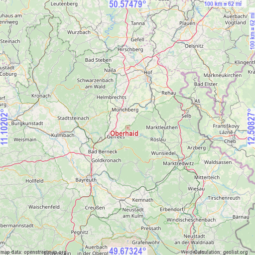
Oberhaid GPS coordinates[2]
50° 7' 34.104" North, 11° 48' 18.504" East
| Map corner | latitude | longitude |
|---|---|---|
| Upper-left | 50.57479°, | 11.10202° |
| Center: | 50.12614°, | 11.80514° |
| Lower-right: | 49.67324°, | 12.50827° |
| Map W x H: | 100.2×100.2 km | = 62.3×62.3mi |
| max Lat: | 55.01917° ⇑60.7% North |
| Oberhaid: | 50.12614° |
| min Lat: | ⇓39.3% South 47.40724° |
| min Long | Oberhaid | max Long |
| 5.92978° | 11.80514° | 14.98853° |
| W 78.9%⇐ | ⇒21.1% E |
Elevation
Elevation of Oberhaid is 629 m = 2064 ft, and this is 379.9 m = 1246 ft above average elevation for this country.
| Max E: |
1256 m = 4121 ft | 4% |
| Oberhaid | 629 m 2064 ft | |
| Avg. | 249.1 m = 817 ft | |
Min E: |
-5 m = -16 ft | 96% |
See also: Germany elevation on elevation.city.
Geographical zone
Oberhaid is located in North temperate zone (between Tropic of Cancer and the Arctic Circle). Distance of this North polar circle is 1827.7 km =1135.7 mi to North.| Distance of | km | miles | from Oberhaid |
|---|---|---|---|
| North Pole | 4433.6 | 2754.9 | to North |
| Arctic Circle | 1827.7 | 1135.7 | to North |
| Tropic Cancer | 2967.6 | 1844 | to South |
| Equator | 5573.5 | 3463.2 | to South |


Nearby cities:
15 places around Oberhaid: (largest is in red/bold)
• Bad Berneck im Fichtelgebirge
13 km =8.1 mi,  226°
226°
• Bischofsgrün
8.3 km =5.2 mi,  182°
182°
• Gefrees
5.9 km =3.7 mi, 234°
• Grub
9.2 km =5.7 mi,  106°
106°
• Kirchenlamitz
10.6 km =6.6 mi,  74°
74°
• Marktleugast
13.3 km =8.3 mi,  293°
293°
• Marktschorgast
11.3 km =7 mi,  251°
251°
• Münchberg
7.1 km =4.4 mi,  350°
350°
• Röslau
13.6 km =8.5 mi, 110°
• Sparneck
4.8 km =3 mi,  34°
34°
• Stammbach
8.4 km =5.2 mi,  284°
284°
• Steinbach
11.4 km =7.1 mi, 285°
• Weißdorf
7.1 km =4.4 mi, 26°
• Weißenstadt
6.5 km =4 mi, 114°
• Zell im Fichtelgebirge
1.6 km =1 mi,  50°
50°
Sources, notices
• [Note1] Compared only with cities in Germany existing in our database
• [Src1] Map data: © OpenStreetMap contributors (CC-BY-SA)
• [Src2] Other city data from geonames.org with taken over terms of usage.
• [Src3] Geographical zone / Annual Mean Temperature by Robert A. Rohde @ Wikipedia
