Helmbrechts geodata
Helmbrechts (Bavaria) is a populated place; located in Germany in Europe/Berlin (GMT+2) time zone. With population of 9,493 people, there are 1706 cities with bigger population in this country. Compared to other cities in Germany, 58.2% of cities are located further ↑North; 77.4% of cities are located further ←West and 95.8% of cities have lower elevation than Helmbrechts. Note1
Administrative division(s):
- Level 1: Bavaria
- Level 2: Upper Franconia
- Level 3: Landkreis Hof
- Level 4: Helmbrechts


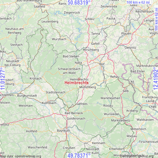
Helmbrechts GPS coordinates[2]
50° 14' 8.052" North, 11° 42' 57.204" East
| Map corner | latitude | longitude |
|---|---|---|
| Upper-left | 50.68319°, | 11.01277° |
| Center: | 50.23557°, | 11.71589° |
| Lower-right: | 49.78371°, | 12.41902° |
| Map W x H: | 100×100 km | = 62.1×62.1mi |
| max Lat: | 55.01917° ⇑58.2% North |
| Helmbrechts: | 50.23557° |
| min Lat: | ⇓41.8% South 47.40724° |
| min Long | Helmbrechts | max Long |
| 5.92978° | 11.71589° | 14.98853° |
| W 77.4%⇐ | ⇒22.6% E |
Elevation
Elevation of Helmbrechts is 621 m = 2037 ft, and this is 371.9 m = 1220 ft above average elevation for this country.
| Max E: |
1256 m = 4121 ft | 4.2% |
| Helmbrechts | 621 m 2037 ft | |
| Avg. | 249.1 m = 817 ft | |
Min E: |
-5 m = -16 ft | 95.8% |
See also: Germany elevation on elevation.city.
Geographical zone
Helmbrechts is located in North temperate zone (between Tropic of Cancer and the Arctic Circle). Distance of this North polar circle is 1815.5 km =1128.1 mi to North.| Distance of | km | miles | from Helmbrechts |
|---|---|---|---|
| North Pole | 4421.4 | 2747.3 | to North |
| Arctic Circle | 1815.5 | 1128.1 | to North |
| Tropic Cancer | 2979.8 | 1851.6 | to South |
| Equator | 5585.7 | 3470.8 | to South |


Nearby cities:
15 places around Helmbrechts: (largest is in red/bold)
• Grafengehaig
9.4 km =5.8 mi,  247°
247°
• Konradsreuth
10.1 km =6.3 mi,  70°
70°
• Kunreuth
13.1 km =8.1 mi,  268°
268°
• Leupoldsgrün
9.3 km =5.8 mi,  39°
39°
• Marktleugast
9.1 km =5.7 mi,  220°
220°
• Münchberg
7.3 km =4.5 mi,  134°
134°
• Naila
10.6 km =6.6 mi,  355°
355°
• Presseck
11.5 km =7.1 mi, 265°
• Schauenstein
5.1 km =3.2 mi,  21°
21°
• Selbitz
9.4 km =5.8 mi, 15°
• Sparneck
12.2 km =7.6 mi, 131°
• Stammbach
10.2 km =6.3 mi,  189°
189°
• Steinbach
10.3 km =6.4 mi,  206°
206°
• Weißdorf
11.2 km =7 mi,  121°
121°
• Zell im Fichtelgebirge
13.5 km =8.4 mi,  145°
145°
Sources, notices
• [Note1] Compared only with cities in Germany existing in our database
• [Src1] Map data: © OpenStreetMap contributors (CC-BY-SA)
• [Src2] Other city data from geonames.org with taken over terms of usage.
• [Src3] Geographical zone / Annual Mean Temperature by Robert A. Rohde @ Wikipedia
