Speichersdorf geodata
Speichersdorf (Bavaria) is a seat of a fourth-order administrative division; located in Germany in Europe/Berlin (GMT+2) time zone. With population of 6,284 people, there are 2371 cities with bigger population in this country. Compared to other cities in Germany, 67.1% of cities are located further ↑North; 78.5% of cities are located further ←West and 84.4% of cities have lower elevation than Speichersdorf. Note1
Administrative division(s):
- Level 1: Bavaria
- Level 2: Upper Franconia
- Level 3: Landkreis Bayreuth
- Level 4: Speichersdorf


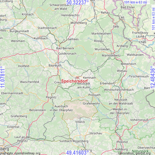
Speichersdorf GPS coordinates[2]
49° 52' 16.788" North, 11° 46' 52.428" East
| Map corner | latitude | longitude |
|---|---|---|
| Upper-left | 50.32237°, | 11.07811° |
| Center: | 49.87133°, | 11.78123° |
| Lower-right: | 49.41603°, | 12.48436° |
| Map W x H: | 100.8×100.8 km | = 62.6×62.6mi |
| max Lat: | 55.01917° ⇑67.1% North |
| Speichersdorf: | 49.87133° |
| min Lat: | ⇓32.9% South 47.40724° |
| min Long | Speichersdorf | max Long |
| 5.92978° | 11.78123° | 14.98853° |
| W 78.5%⇐ | ⇒21.5% E |
Elevation
Elevation of Speichersdorf is 464 m = 1522 ft, and this is 214.9 m = 705 ft above average elevation for this country.
| Max E: |
1256 m = 4121 ft | 15.6% |
| Speichersdorf | 464 m 1522 ft | |
| Avg. | 249.1 m = 817 ft | |
Min E: |
-5 m = -16 ft | 84.4% |
See also: Germany elevation on elevation.city.
Geographical zone
Speichersdorf is located in North temperate zone (between Tropic of Cancer and the Arctic Circle). Distance of this North polar circle is 1856 km =1153.3 mi to North.| Distance of | km | miles | from Speichersdorf |
|---|---|---|---|
| North Pole | 4461.9 | 2772.5 | to North |
| Arctic Circle | 1856 | 1153.3 | to North |
| Tropic Cancer | 2939.3 | 1826.4 | to South |
| Equator | 5545.2 | 3445.6 | to South |


Nearby cities:
15 places around Speichersdorf: (largest is in red/bold)
• Creußen
11.4 km =7.1 mi,  255°
255°
• Emtmannsberg
10.1 km =6.3 mi,  283°
283°
• Immenreuth
6.9 km =4.3 mi,  62°
62°
• Kastl
9.5 km =5.9 mi,  116°
116°
• Kemnath
7.9 km =4.9 mi,  91°
91°
• Kirchenpingarten
6.9 km =4.3 mi,  1°
1°
• Kulmain
9.1 km =5.7 mi,  69°
69°
• Neunkirchen am Main
11.1 km =6.9 mi,  301°
301°
• Plößberg
8.3 km =5.2 mi,  49°
49°
• Prebitz
8.2 km =5.1 mi,  238°
238°
• Schlammersdorf
8.6 km =5.3 mi,  203°
203°
• Seybothenreuth
6 km =3.7 mi,  294°
294°
• Speinshart
9.4 km =5.8 mi,  163°
163°
• Trabitz
11.6 km =7.2 mi,  132°
132°
• Vorbach
6.4 km =4 mi,  210°
210°
Sources, notices
• [Note1] Compared only with cities in Germany existing in our database
• [Src1] Map data: © OpenStreetMap contributors (CC-BY-SA)
• [Src2] Other city data from geonames.org with taken over terms of usage.
• [Src3] Geographical zone / Annual Mean Temperature by Robert A. Rohde @ Wikipedia
