Sonthofen geodata
Sonthofen (Bavaria) is a seat of a third-order administrative division; located in Germany in Europe/Berlin (GMT+2) time zone. With population of 21,285 people, there are 718 cities with bigger population in this country. Compared to other cities in Germany, 99.9% of cities are located further ↑North; 54.9% of cities are located further ←West and 98.7% of cities have lower elevation than Sonthofen. Note1
Administrative division(s):
- Level 1: Bavaria
- Level 2: Swabia
- Level 3: Landkreis Oberallgäu
- Level 4: Sonthofen


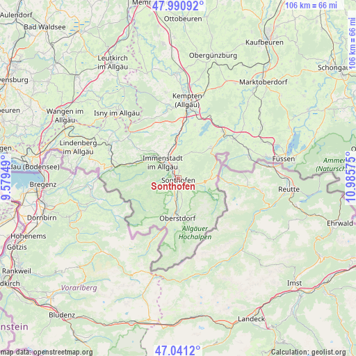
Sonthofen GPS coordinates[2]
47° 31' 5.556" North, 10° 16' 57.432" East
| Map corner | latitude | longitude |
|---|---|---|
| Upper-left | 47.99092°, | 9.57949° |
| Center: | 47.51821°, | 10.28262° |
| Lower-right: | 47.0412°, | 10.98575° |
| Map W x H: | 105.6×105.6 km | = 65.6×65.6mi |
| max Lat: | 55.01917° ⇑99.9% North |
| Sonthofen: | 47.51821° |
| min Lat: | ⇓0.1% South 47.40724° |
| min Long | Sonthofen | max Long |
| 5.92978° | 10.28262° | 14.98853° |
| W 54.9%⇐ | ⇒45.1% E |
Elevation
Elevation of Sonthofen is 746 m = 2448 ft, and this is 496.9 m = 1630 ft above average elevation for this country.
| Max E: |
1256 m = 4121 ft | 1.3% |
| Sonthofen | 746 m 2448 ft | |
| Avg. | 249.1 m = 817 ft | |
Min E: |
-5 m = -16 ft | 98.7% |
See also: Germany elevation on elevation.city.
Geographical zone
Sonthofen is located in North temperate zone (between Tropic of Cancer and the Arctic Circle). Distance of this North polar circle is 2117.6 km =1315.8 mi to North.| Distance of | km | miles | from Sonthofen |
|---|---|---|---|
| North Pole | 4723.5 | 2935 | to North |
| Arctic Circle | 2117.6 | 1315.8 | to North |
| Tropic Cancer | 2677.6 | 1663.8 | to South |
| Equator | 5283.5 | 3283 | to South |


Nearby cities:
15 places around Sonthofen: (largest is in red/bold)
• Balderschwang
14.9 km =9.3 mi,  247°
247°
• Blaichach
3.2 km =2 mi,  325°
325°
• Bolsterlang
6.8 km =4.2 mi,  212°
212°
• Burgberg
2.1 km =1.3 mi,  12°
12°
• Immenstadt im Allgäu
6.9 km =4.3 mi,  312°
312°
• Missen-Wilhams
15.4 km =9.6 mi, 306°
• Obermaiselstein
8.4 km =5.2 mi, 206°
• Oberstdorf
12.3 km =7.6 mi,  181°
181°
• Ofterschwang
4.2 km =2.6 mi,  241°
241°
• Oy-Mittelberg
17.1 km =10.6 mi,  41°
41°
• Rettenberg
6.3 km =3.9 mi, 6°
• Sulzberg
16.6 km =10.3 mi,  17°
17°
• Waltenhofen
17.3 km =10.7 mi, 6°
• Weitnau
18 km =11.2 mi,  319°
319°
• Wertach
13.4 km =8.3 mi,  45°
45°
Sources, notices
• [Note1] Compared only with cities in Germany existing in our database
• [Src1] Map data: © OpenStreetMap contributors (CC-BY-SA)
• [Src2] Other city data from geonames.org with taken over terms of usage.
• [Src3] Geographical zone / Annual Mean Temperature by Robert A. Rohde @ Wikipedia
