Obermaiselstein geodata
Obermaiselstein (Bavaria) is a seat of a fourth-order administrative division; located in Germany in Europe/Berlin (GMT+2) time zone. With population of 981 people, there are 7247 cities with bigger population in this country. Compared to other cities in Germany, 100% of cities are located further ↑North; 53.9% of cities are located further ←West and 99.7% of cities have lower elevation than Obermaiselstein. Note1
Administrative division(s):
- Level 1: Bavaria
- Level 2: Swabia
- Level 3: Landkreis Oberallgäu
- Level 4: Obermaiselstein


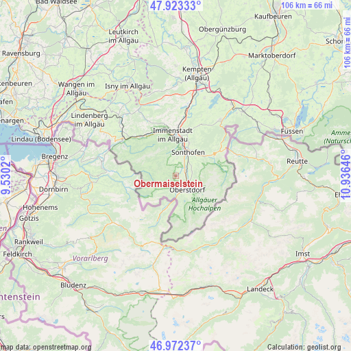
Obermaiselstein GPS coordinates[2]
47° 27' 0" North, 10° 13' 59.988" East
| Map corner | latitude | longitude |
|---|---|---|
| Upper-left | 47.92333°, | 9.5302° |
| Center: | 47.45°, | 10.23333° |
| Lower-right: | 46.97237°, | 10.93646° |
| Map W x H: | 105.7×105.7 km | = 65.7×65.7mi |
| max Lat: | 55.01917° ⇑100% North |
| Obermaiselstein: | 47.45° |
| min Lat: | ⇓0% South 47.40724° |
| min Long | Obermaiselstein | max Long |
| 5.92978° | 10.23333° | 14.98853° |
| W 53.9%⇐ | ⇒46.1% E |
Elevation
Elevation of Obermaiselstein is 877 m = 2877 ft, and this is 627.9 m = 2060 ft above average elevation for this country.
| Max E: |
1256 m = 4121 ft | 0.3% |
| Obermaiselstein | 877 m 2877 ft | |
| Avg. | 249.1 m = 817 ft | |
Min E: |
-5 m = -16 ft | 99.7% |
See also: Germany elevation on elevation.city.
Geographical zone
Obermaiselstein is located in North temperate zone (between Tropic of Cancer and the Arctic Circle). Distance of this North polar circle is 2125.2 km =1320.5 mi to North.| Distance of | km | miles | from Obermaiselstein |
|---|---|---|---|
| North Pole | 4731.1 | 2939.8 | to North |
| Arctic Circle | 2125.2 | 1320.5 | to North |
| Tropic Cancer | 2670 | 1659.1 | to South |
| Equator | 5275.9 | 3278.3 | to South |


Nearby cities:
15 places around Obermaiselstein: (largest is in red/bold)
• Balderschwang
10.2 km =6.3 mi,  280°
280°
• Blaichach
10.4 km =6.5 mi,  10°
10°
• Bolsterlang
1.9 km =1.2 mi,  0°
0°
• Burgberg
10.5 km =6.5 mi,  23°
23°
• Immenstadt im Allgäu
12.3 km =7.6 mi,  353°
353°
• Missen-Wilhams
18.8 km =11.7 mi,  332°
332°
• Oberstaufen
19.7 km =12.2 mi,  306°
306°
• Oberstdorf
5.9 km =3.7 mi,  143°
143°
• Ofterschwang
5.6 km =3.5 mi, 0°
• Rettenberg
14.5 km =9 mi, 17°
• Sonthofen
8.4 km =5.2 mi,  26°
26°
• Stiefenhofen
23.5 km =14.6 mi, 312°
• Sulzberg
25 km =15.5 mi, 20°
• Weitnau
22.8 km =14.2 mi,  339°
339°
• Wertach
21.6 km =13.4 mi,  37°
37°
Sources, notices
• [Note1] Compared only with cities in Germany existing in our database
• [Src1] Map data: © OpenStreetMap contributors (CC-BY-SA)
• [Src2] Other city data from geonames.org with taken over terms of usage.
• [Src3] Geographical zone / Annual Mean Temperature by Robert A. Rohde @ Wikipedia
