Burgberg geodata
Burgberg (Bavaria) is a populated place; located in Germany in Europe/Berlin (GMT+2) time zone. With population of 3,124 people, there are 3897 cities with bigger population in this country. Compared to other cities in Germany, 99.9% of cities are located further ↑North; 55.1% of cities are located further ←West and 99% of cities have lower elevation than Burgberg. Note1
Administrative division(s):
- Level 1: Bavaria
- Level 2: Swabia
- Level 3: Landkreis Oberallgäu
- Level 4: Burgberg i.Allgäu


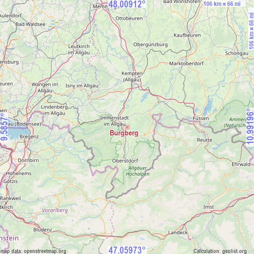
Burgberg GPS coordinates[2]
47° 32' 11.652" North, 10° 17' 19.788" East
| Map corner | latitude | longitude |
|---|---|---|
| Upper-left | 48.00912°, | 9.5857° |
| Center: | 47.53657°, | 10.28883° |
| Lower-right: | 47.05973°, | 10.99196° |
| Map W x H: | 105.6×105.6 km | = 65.6×65.6mi |
| max Lat: | 55.01917° ⇑99.9% North |
| Burgberg: | 47.53657° |
| min Lat: | ⇓0.1% South 47.40724° |
| min Long | Burgberg | max Long |
| 5.92978° | 10.28883° | 14.98853° |
| W 55.1%⇐ | ⇒44.9% E |
Elevation
Elevation of Burgberg is 775 m = 2543 ft, and this is 525.9 m = 1725 ft above average elevation for this country.
| Max E: |
1256 m = 4121 ft | 1% |
| Burgberg | 775 m 2543 ft | |
| Avg. | 249.1 m = 817 ft | |
Min E: |
-5 m = -16 ft | 99% |
See also: Germany elevation on elevation.city.
Geographical zone
Burgberg is located in North temperate zone (between Tropic of Cancer and the Arctic Circle). Distance of this North polar circle is 2115.6 km =1314.6 mi to North.| Distance of | km | miles | from Burgberg |
|---|---|---|---|
| North Pole | 4721.5 | 2933.8 | to North |
| Arctic Circle | 2115.6 | 1314.6 | to North |
| Tropic Cancer | 2679.7 | 1665.1 | to South |
| Equator | 5285.6 | 3284.3 | to South |


Nearby cities:
15 places around Burgberg: (largest is in red/bold)
• Balderschwang
16.2 km =10.1 mi,  241°
241°
• Blaichach
2.4 km =1.5 mi,  285°
285°
• Bolsterlang
8.8 km =5.5 mi,  208°
208°
• Immenstadt im Allgäu
6.2 km =3.9 mi, 294°
• Missen-Wilhams
14.7 km =9.1 mi,  298°
298°
• Obermaiselstein
10.5 km =6.5 mi,  203°
203°
• Oberstdorf
14.4 km =8.9 mi,  182°
182°
• Ofterschwang
5.8 km =3.6 mi,  225°
225°
• Oy-Mittelberg
15.3 km =9.5 mi,  45°
45°
• Rettenberg
4.2 km =2.6 mi,  2°
2°
• Sonthofen
2.1 km =1.3 mi,  192°
192°
• Sulzberg
14.5 km =9 mi,  18°
18°
• Waltenhofen
15.3 km =9.5 mi,  5°
5°
• Weitnau
16.8 km =10.4 mi,  313°
313°
• Wertach
11.7 km =7.3 mi, 50°
Sources, notices
• [Note1] Compared only with cities in Germany existing in our database
• [Src1] Map data: © OpenStreetMap contributors (CC-BY-SA)
• [Src2] Other city data from geonames.org with taken over terms of usage.
• [Src3] Geographical zone / Annual Mean Temperature by Robert A. Rohde @ Wikipedia
