Immenstadt im Allgäu geodata
Immenstadt im Allgäu (Bavaria) is a populated place; located in Germany in Europe/Berlin (GMT+2) time zone. With population of 14,431 people, there are 1095 cities with bigger population in this country. Compared to other cities in Germany, 99.8% of cities are located further ↑North; 53.5% of cities are located further ←West and 98.4% of cities have lower elevation than Immenstadt im Allgäu. Note1
Administrative division(s):
- Level 1: Bavaria
- Level 2: Swabia
- Level 3: Landkreis Oberallgäu
- Level 4: Immenstadt i.Allgäu


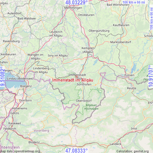
Immenstadt im Allgäu GPS coordinates[2]
47° 33' 35.856" North, 10° 12' 50.184" East
| Map corner | latitude | longitude |
|---|---|---|
| Upper-left | 48.03229°, | 9.51082° |
| Center: | 47.55996°, | 10.21394° |
| Lower-right: | 47.08333°, | 10.91707° |
| Map W x H: | 105.5×105.5 km | = 65.6×65.6mi |
| max Lat: | 55.01917° ⇑99.8% North |
| Immenstadt im Allgäu: | 47.55996° |
| min Lat: | ⇓0.2% South 47.40724° |
| min Long | Immenstadt im A | max Long |
| 5.92978° | 10.21394° | 14.98853° |
| W 53.5%⇐ | ⇒46.5% E |
Elevation
Elevation of Immenstadt im Allgäu is 733 m = 2405 ft, and this is 483.9 m = 1588 ft above average elevation for this country.
| Max E: |
1256 m = 4121 ft | 1.6% |
| Immenstadt im Allgäu | 733 m 2405 ft | |
| Avg. | 249.1 m = 817 ft | |
Min E: |
-5 m = -16 ft | 98.4% |
See also: Germany elevation on elevation.city.
Geographical zone
Immenstadt im Allgäu is located in North temperate zone (between Tropic of Cancer and the Arctic Circle). Distance of this North polar circle is 2113 km =1313 mi to North.| Distance of | km | miles | from Immenstadt im Allgäu |
|---|---|---|---|
| North Pole | 4718.9 | 2932.2 | to North |
| Arctic Circle | 2113 | 1313 | to North |
| Tropic Cancer | 2682.3 | 1666.7 | to South |
| Equator | 5288.2 | 3285.9 | to South |


Nearby cities:
15 places around Immenstadt im Allgäu: (largest is in red/bold)
• Balderschwang
13.4 km =8.3 mi,  219°
219°
• Blaichach
3.9 km =2.4 mi,  120°
120°
• Bolsterlang
10.5 km =6.5 mi,  172°
172°
• Buchenberg
15.2 km =9.4 mi,  7°
7°
• Burgberg
6.2 km =3.9 mi,  114°
114°
• Missen-Wilhams
8.5 km =5.3 mi,  301°
301°
• Obermaiselstein
12.3 km =7.6 mi, 173°
• Oberstaufen
14.4 km =8.9 mi,  268°
268°
• Ofterschwang
6.8 km =4.2 mi, 167°
• Rettenberg
6 km =3.7 mi,  74°
74°
• Sonthofen
6.9 km =4.3 mi,  132°
132°
• Sulzberg
15.1 km =9.4 mi,  42°
42°
• Waltenhofen
14.4 km =8.9 mi,  28°
28°
• Weitnau
11.2 km =7 mi,  324°
324°
• Wertach
15.4 km =9.6 mi, 71°
Sources, notices
• [Note1] Compared only with cities in Germany existing in our database
• [Src1] Map data: © OpenStreetMap contributors (CC-BY-SA)
• [Src2] Other city data from geonames.org with taken over terms of usage.
• [Src3] Geographical zone / Annual Mean Temperature by Robert A. Rohde @ Wikipedia
