Simmershofen geodata
Simmershofen (Bavaria) is a seat of a fourth-order administrative division; located in Germany in Europe/Berlin (GMT+2) time zone. With population of 996 people, there are 7198 cities with bigger population in this country. Compared to other cities in Germany, 75.2% of cities are located further ↑North; 52.2% of cities are located further ←West and 64.7% of cities have lower elevation than Simmershofen. Note1
Administrative division(s):
- Level 1: Bavaria
- Level 2: Regierungsbezirk Mittelfranken
- Level 3: Landkreis Neustadt an der Aisch-Bad Windsheim
- Level 4: Simmershofen


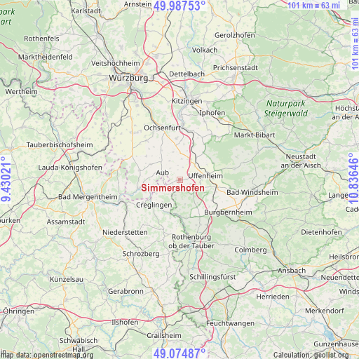
Simmershofen GPS coordinates[2]
49° 31' 59.988" North, 10° 7' 59.988" East
| Map corner | latitude | longitude |
|---|---|---|
| Upper-left | 49.98753°, | 9.43021° |
| Center: | 49.53333°, | 10.13333° |
| Lower-right: | 49.07487°, | 10.83646° |
| Map W x H: | 101.5×101.5 km | = 63.1×63.1mi |
| max Lat: | 55.01917° ⇑75.2% North |
| Simmershofen: | 49.53333° |
| min Lat: | ⇓24.8% South 47.40724° |
| min Long | Simmershofen | max Long |
| 5.92978° | 10.13333° | 14.98853° |
| W 52.2%⇐ | ⇒47.8% E |
Elevation
Elevation of Simmershofen is 319 m = 1047 ft, and this is 69.9 m = 229 ft above average elevation for this country.
| Max E: |
1256 m = 4121 ft | 35.3% |
| Simmershofen | 319 m 1047 ft | |
| Avg. | 249.1 m = 817 ft | |
Min E: |
-5 m = -16 ft | 64.7% |
See also: Germany elevation on elevation.city.
Geographical zone
Simmershofen is located in North temperate zone (between Tropic of Cancer and the Arctic Circle). Distance of this North polar circle is 1893.6 km =1176.6 mi to North.| Distance of | km | miles | from Simmershofen |
|---|---|---|---|
| North Pole | 4499.5 | 2795.9 | to North |
| Arctic Circle | 1893.6 | 1176.6 | to North |
| Tropic Cancer | 2901.7 | 1803 | to South |
| Equator | 5507.6 | 3422.3 | to South |


Nearby cities:
15 places around Simmershofen: (largest is in red/bold)
• Adelshofen
11.4 km =7.1 mi,  167°
167°
• Aub
5.4 km =3.4 mi,  293°
293°
• Bieberehren
9.1 km =5.7 mi,  258°
258°
• Creglingen
10.2 km =6.3 mi,  226°
226°
• Gelchsheim
9.2 km =5.7 mi,  297°
297°
• Gollhofen
5.8 km =3.6 mi,  46°
46°
• Hemmersheim
4.2 km =2.6 mi,  320°
320°
• Ippesheim
10.1 km =6.3 mi,  40°
40°
• Martinsheim
10.1 km =6.3 mi,  6°
6°
• Oberickelsheim
7.4 km =4.6 mi,  0°
0°
• Ohrenbach
8.9 km =5.5 mi,  141°
141°
• Riedenheim
11.5 km =7.1 mi,  283°
283°
• Sonderhofen
11.5 km =7.1 mi,  305°
305°
• Uffenheim
7.3 km =4.5 mi,  80°
80°
• Weigenheim
10.6 km =6.6 mi,  63°
63°
Sources, notices
• [Note1] Compared only with cities in Germany existing in our database
• [Src1] Map data: © OpenStreetMap contributors (CC-BY-SA)
• [Src2] Other city data from geonames.org with taken over terms of usage.
• [Src3] Geographical zone / Annual Mean Temperature by Robert A. Rohde @ Wikipedia
