Simmelsdorf geodata
Simmelsdorf (Bavaria) is a seat of a fourth-order administrative division; located in Germany in Europe/Berlin (GMT+2) time zone. With population of 3,372 people, there are 3702 cities with bigger population in this country. Compared to other cities in Germany, 73.9% of cities are located further ↑North; 71.8% of cities are located further ←West and 72.5% of cities have lower elevation than Simmelsdorf. Note1
Administrative division(s):
- Level 1: Bavaria
- Level 2: Regierungsbezirk Mittelfranken
- Level 3: Nürnberger Land
- Level 4: Simmelsdorf


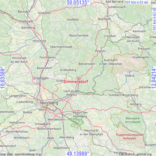
Simmelsdorf GPS coordinates[2]
49° 35' 51.9" North, 11° 20' 20.436" East
| Map corner | latitude | longitude |
|---|---|---|
| Upper-left | 50.05135°, | 10.63589° |
| Center: | 49.59775°, | 11.33901° |
| Lower-right: | 49.13989°, | 12.04214° |
| Map W x H: | 101.3×101.3 km | = 62.9×62.9mi |
| max Lat: | 55.01917° ⇑73.9% North |
| Simmelsdorf: | 49.59775° |
| min Lat: | ⇓26.1% South 47.40724° |
| min Long | Simmelsdorf | max Long |
| 5.92978° | 11.33901° | 14.98853° |
| W 71.8%⇐ | ⇒28.2% E |
Elevation
Elevation of Simmelsdorf is 378 m = 1240 ft, and this is 128.9 m = 423 ft above average elevation for this country.
| Max E: |
1256 m = 4121 ft | 27.5% |
| Simmelsdorf | 378 m 1240 ft | |
| Avg. | 249.1 m = 817 ft | |
Min E: |
-5 m = -16 ft | 72.5% |
See also: Germany elevation on elevation.city.
Geographical zone
Simmelsdorf is located in North temperate zone (between Tropic of Cancer and the Arctic Circle). Distance of this North polar circle is 1886.4 km =1172.2 mi to North.| Distance of | km | miles | from Simmelsdorf |
|---|---|---|---|
| North Pole | 4492.3 | 2791.4 | to North |
| Arctic Circle | 1886.4 | 1172.2 | to North |
| Tropic Cancer | 2908.8 | 1807.4 | to South |
| Equator | 5514.8 | 3426.7 | to South |


Nearby cities:
15 places around Simmelsdorf: (largest is in red/bold)
• Gräfenberg
8.3 km =5.2 mi,  308°
308°
• Henfenfeld
11.7 km =7.3 mi,  161°
161°
• Hersbruck
11.7 km =7.3 mi,  145°
145°
• Hiltpoltstein
7.1 km =4.4 mi,  350°
350°
• Igensdorf
8.3 km =5.2 mi,  290°
290°
• Kirchensittenbach
7.6 km =4.7 mi,  127°
127°
• Lauf an der Pegnitz
10.2 km =6.3 mi,  203°
203°
• Neunkirchen am Sand
8.2 km =5.1 mi,  189°
189°
• Obertrubach
11.4 km =7.1 mi,  3°
3°
• Ottensoos
9.8 km =6.1 mi,  178°
178°
• Reichenschwand
9.6 km =6 mi,  165°
165°
• Schnaittach
4.3 km =2.7 mi, 175°
• Velden
12.5 km =7.8 mi,  81°
81°
• Vorra
12.1 km =7.5 mi,  111°
111°
• Weißenohe
7.2 km =4.5 mi,  300°
300°
Sources, notices
• [Note1] Compared only with cities in Germany existing in our database
• [Src1] Map data: © OpenStreetMap contributors (CC-BY-SA)
• [Src2] Other city data from geonames.org with taken over terms of usage.
• [Src3] Geographical zone / Annual Mean Temperature by Robert A. Rohde @ Wikipedia
