Sierscheid geodata
Sierscheid (Rheinland-Pfalz) is a seat of a fourth-order administrative division; located in Germany in Europe/Berlin (GMT+2) time zone. With population of 104 people, there are 10824 cities with bigger population in this country. Compared to other cities in Germany, 53.6% of cities are located further ↑North; 94.3% of cities are located further →East and 73% of cities have lower elevation than Sierscheid. Note1
Administrative division(s):
- Level 1: Rheinland-Pfalz
- Level 3: Landkreis Ahrweiler
- Level 4: Sierscheid


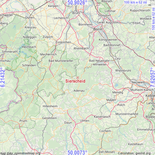
Sierscheid GPS coordinates[2]
50° 27' 25.452" North, 6° 55' 2.784" East
| Map corner | latitude | longitude |
|---|---|---|
| Upper-left | 50.9026°, | 6.21432° |
| Center: | 50.45707°, | 6.91744° |
| Lower-right: | 50.0073°, | 7.62057° |
| Map W x H: | 99.5×99.5 km | = 61.8×61.8mi |
| max Lat: | 55.01917° ⇑53.6% North |
| Sierscheid: | 50.45707° |
| min Lat: | ⇓46.4% South 47.40724° |
| min Long | Sierscheid | max Long |
| 5.92978° | 6.91744° | 14.98853° |
| W 5.7%⇐ | ⇒94.3% E |
Elevation
Elevation of Sierscheid is 382 m = 1253 ft, and this is 132.9 m = 436 ft above average elevation for this country.
| Max E: |
1256 m = 4121 ft | 27% |
| Sierscheid | 382 m 1253 ft | |
| Avg. | 249.1 m = 817 ft | |
Min E: |
-5 m = -16 ft | 73% |
See also: Germany elevation on elevation.city.
Geographical zone
Sierscheid is located in North temperate zone (between Tropic of Cancer and the Arctic Circle). Distance of this North polar circle is 1790.9 km =1112.8 mi to North.| Distance of | km | miles | from Sierscheid |
|---|---|---|---|
| North Pole | 4396.8 | 2732 | to North |
| Arctic Circle | 1790.9 | 1112.8 | to North |
| Tropic Cancer | 3004.4 | 1866.8 | to South |
| Equator | 5610.3 | 3486.1 | to South |


Nearby cities:
15 places around Sierscheid: (largest is in red/bold)
• Ahrbrück
5.7 km =3.5 mi,  60°
60°
• Dümpelfeld
3.5 km =2.2 mi,  138°
138°
• Eichenbach
7.6 km =4.7 mi,  249°
249°
• Fuchshofen
5.7 km =3.5 mi,  235°
235°
• Harscheid
1.8 km =1.1 mi,  279°
279°
• Hönningen
2.5 km =1.6 mi,  65°
65°
• Insul
2.6 km =1.6 mi,  181°
181°
• Kesseling
7.6 km =4.7 mi, 67°
• Kirchsahr
7.4 km =4.6 mi,  350°
350°
• Leimbach
6 km =3.7 mi,  172°
172°
• Lind
4.9 km =3 mi,  13°
13°
• Reifferscheid
6.2 km =3.9 mi,  201°
201°
• Schuld
2.3 km =1.4 mi, 242°
• Wershofen
7.5 km =4.7 mi,  259°
259°
• Winnerath
4.3 km =2.7 mi,  222°
222°
Sources, notices
• [Note1] Compared only with cities in Germany existing in our database
• [Src1] Map data: © OpenStreetMap contributors (CC-BY-SA)
• [Src2] Other city data from geonames.org with taken over terms of usage.
• [Src3] Geographical zone / Annual Mean Temperature by Robert A. Rohde @ Wikipedia
