Sessenhausen geodata
Sessenhausen (Rheinland-Pfalz) is a seat of a fourth-order administrative division; located in Germany in Europe/Berlin (GMT+2) time zone. With population of 922 people, there are 7450 cities with bigger population in this country. Compared to other cities in Germany, 52.2% of cities are located further ↑North; 82.8% of cities are located further →East and 56.5% of cities have lower elevation than Sessenhausen. Note1


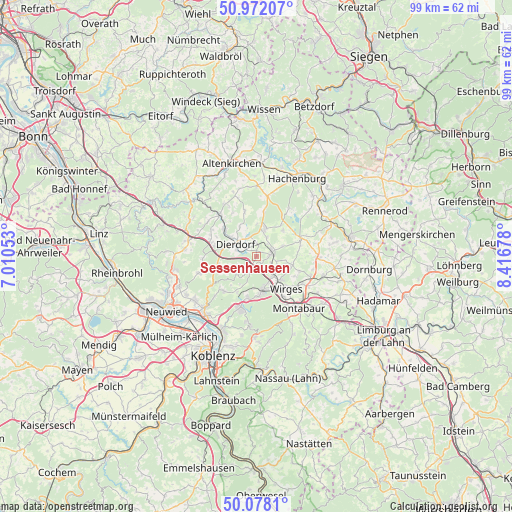
Sessenhausen GPS coordinates[2]
50° 31' 37.92" North, 7° 42' 49.14" East
| Map corner | latitude | longitude |
|---|---|---|
| Upper-left | 50.97207°, | 7.01053° |
| Center: | 50.5272°, | 7.71365° |
| Lower-right: | 50.0781°, | 8.41678° |
| Map W x H: | 99.4×99.4 km | = 61.8×61.8mi |
| max Lat: | 55.01917° ⇑52.2% North |
| Sessenhausen: | 50.5272° |
| min Lat: | ⇓47.8% South 47.40724° |
| min Long | Sessenhausen | max Long |
| 5.92978° | 7.71365° | 14.98853° |
| W 17.2%⇐ | ⇒82.8% E |
Elevation
Elevation of Sessenhausen is 269 m = 883 ft, and this is 19.9 m = 65 ft above average elevation for this country.
| Max E: |
1256 m = 4121 ft | 43.5% |
| Sessenhausen | 269 m 883 ft | |
| Avg. | 249.1 m = 817 ft | |
Min E: |
-5 m = -16 ft | 56.5% |
See also: Germany elevation on elevation.city.
Geographical zone
Sessenhausen is located in North temperate zone (between Tropic of Cancer and the Arctic Circle). Distance of this North polar circle is 1783.1 km =1108 mi to North.| Distance of | km | miles | from Sessenhausen |
|---|---|---|---|
| North Pole | 4389 | 2727.2 | to North |
| Arctic Circle | 1783.1 | 1108 | to North |
| Tropic Cancer | 3012.2 | 1871.7 | to South |
| Equator | 5618.1 | 3490.9 | to South |


Nearby cities:
15 places around Sessenhausen: (largest is in red/bold)
• Breitenau
3.6 km =2.2 mi,  206°
206°
• Deesen
2.1 km =1.3 mi, 207°
• Dierdorf
4.8 km =3 mi,  296°
296°
• Ellenhausen
1.5 km =0.9 mi,  145°
145°
• Goddert
3.4 km =2.1 mi,  43°
43°
• Krümmel
1.4 km =0.9 mi, 35°
• Marienhausen
4.3 km =2.7 mi,  340°
340°
• Marienrachdorf
2.5 km =1.6 mi,  4°
4°
• Mogendorf
4.9 km =3 mi,  138°
138°
• Nordhofen
2.8 km =1.7 mi,  114°
114°
• Rückeroth
4.4 km =2.7 mi,  30°
30°
• Selters
3 km =1.9 mi,  78°
78°
• Stebach
4.6 km =2.9 mi,  255°
255°
• Vielbach
4.5 km =2.8 mi, 114°
• Wittgert
3.2 km =2 mi,  197°
197°
Sources, notices
• [Note1] Compared only with cities in Germany existing in our database
• [Src1] Map data: © OpenStreetMap contributors (CC-BY-SA)
• [Src2] Other city data from geonames.org with taken over terms of usage.
• [Src3] Geographical zone / Annual Mean Temperature by Robert A. Rohde @ Wikipedia
