Goddert geodata
Goddert (Rheinland-Pfalz) is a seat of a fourth-order administrative division; located in Germany in Europe/Berlin (GMT+2) time zone. With population of 433 people, there are 9587 cities with bigger population in this country. Compared to other cities in Germany, 51.8% of cities are located further ↑North; 82.2% of cities are located further →East and 57.9% of cities have lower elevation than Goddert. Note1


Goddert GPS coordinates[2]
50° 32' 57.012" North, 7° 44' 48.984" East
| Map corner | latitude | longitude |
|---|---|---|
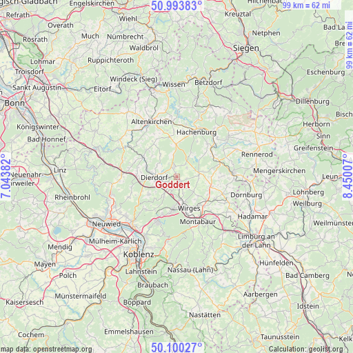
| Upper-left | 50.99383°, | 7.04382° |
| Center: | 50.54917°, | 7.74694° |
| Lower-right: | 50.10027°, | 8.45007° |
| Map W x H: | 99.4×99.4 km | = 61.8×61.8mi |
| max Lat: | 55.01917° ⇑51.8% North |
| Goddert: | 50.54917° |
| min Lat: | ⇓48.2% South 47.40724° |
| min Long | Goddert | max Long |
| 5.92978° | 7.74694° | 14.98853° |
| W 17.8%⇐ | ⇒82.2% E |
Elevation
Elevation of Goddert is 278 m = 912 ft, and this is 28.9 m = 95 ft above average elevation for this country.
| Max E: |
1256 m = 4121 ft | 42.1% |
| Goddert | 278 m 912 ft | |
| Avg. | 249.1 m = 817 ft | |
Min E: |
-5 m = -16 ft | 57.9% |
See also: Germany elevation on elevation.city.
Geographical zone
Goddert is located in North temperate zone (between Tropic of Cancer and the Arctic Circle). Distance of this North polar circle is 1780.6 km =1106.4 mi to North.| Distance of | km | miles | from Goddert |
|---|---|---|---|
| North Pole | 4386.5 | 2725.6 | to North |
| Arctic Circle | 1780.6 | 1106.4 | to North |
| Tropic Cancer | 3014.6 | 1873.2 | to South |
| Equator | 5620.5 | 3492.4 | to South |


Nearby cities:
15 places around Goddert: (largest is in red/bold)
• Ellenhausen
4 km =2.5 mi,  202°
202°
• Freirachdorf
4.4 km =2.7 mi,  330°
330°
• Hartenfels
4 km =2.5 mi,  45°
45°
• Herschbach
3.9 km =2.4 mi,  345°
345°
• Krümmel
2.1 km =1.3 mi,  229°
229°
• Marienhausen
4.2 km =2.6 mi,  293°
293°
• Marienrachdorf
2.1 km =1.3 mi,  272°
272°
• Maxsain
2.8 km =1.7 mi,  103°
103°
• Nordhofen
3.6 km =2.2 mi,  176°
176°
• Quirnbach
4.7 km =2.9 mi,  131°
131°
• Rückeroth
1.4 km =0.9 mi,  355°
355°
• Schenkelberg
4.6 km =2.9 mi,  33°
33°
• Selters
2 km =1.2 mi,  161°
161°
• Sessenhausen
3.4 km =2.1 mi,  223°
223°
• Vielbach
4.6 km =2.9 mi, 157°
Sources, notices
• [Note1] Compared only with cities in Germany existing in our database
• [Src1] Map data: © OpenStreetMap contributors (CC-BY-SA)
• [Src2] Other city data from geonames.org with taken over terms of usage.
• [Src3] Geographical zone / Annual Mean Temperature by Robert A. Rohde @ Wikipedia
