Sankt Englmar geodata
Sankt Englmar (Bavaria) is a seat of a fourth-order administrative division; located in Germany in Europe/Berlin (GMT+2) time zone. With population of 1,568 people, there are 5745 cities with bigger population in this country. Compared to other cities in Germany, 83% of cities are located further ↑North; 91% of cities are located further ←West and 99.5% of cities have lower elevation than Sankt Englmar. Note1
Administrative division(s):
- Level 1: Bavaria
- Level 2: Lower Bavaria
- Level 3: Landkreis Straubing-Bogen
- Level 4: Sankt Englmar


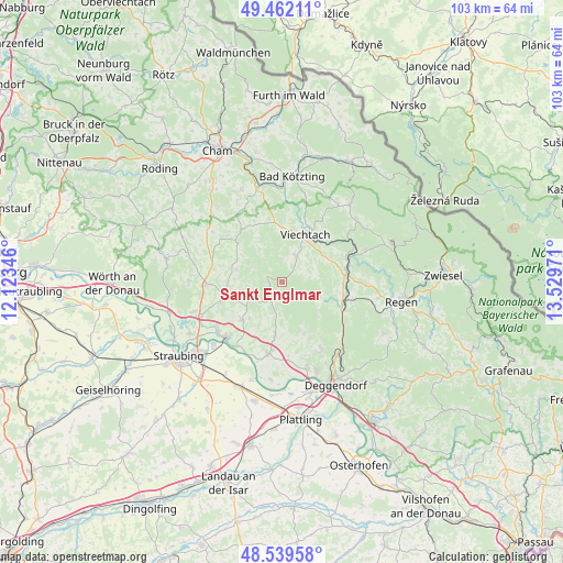
Sankt Englmar GPS coordinates[2]
49° 0' 10.728" North, 12° 49' 35.688" East
| Map corner | latitude | longitude |
|---|---|---|
| Upper-left | 49.46211°, | 12.12346° |
| Center: | 49.00298°, | 12.82658° |
| Lower-right: | 48.53958°, | 13.52971° |
| Map W x H: | 102.6×102.6 km | = 63.8×63.8mi |
| max Lat: | 55.01917° ⇑83% North |
| Sankt Englmar: | 49.00298° |
| min Lat: | ⇓17% South 47.40724° |
| min Long | Sankt Englmar | max Long |
| 5.92978° | 12.82658° | 14.98853° |
| W 91%⇐ | ⇒9% E |
Elevation
Elevation of Sankt Englmar is 840 m = 2756 ft, and this is 590.9 m = 1939 ft above average elevation for this country.
| Max E: |
1256 m = 4121 ft | 0.5% |
| Sankt Englmar | 840 m 2756 ft | |
| Avg. | 249.1 m = 817 ft | |
Min E: |
-5 m = -16 ft | 99.5% |
See also: Germany elevation on elevation.city.
Geographical zone
Sankt Englmar is located in North temperate zone (between Tropic of Cancer and the Arctic Circle). Distance of this North polar circle is 1952.6 km =1213.3 mi to North.| Distance of | km | miles | from Sankt Englmar |
|---|---|---|---|
| North Pole | 4558.4 | 2832.5 | to North |
| Arctic Circle | 1952.6 | 1213.3 | to North |
| Tropic Cancer | 2842.7 | 1766.4 | to South |
| Equator | 5448.6 | 3385.6 | to South |


Nearby cities:
15 places around Sankt Englmar: (largest is in red/bold)
• Achslach
8.6 km =5.3 mi,  113°
113°
• Bernried
10.5 km =6.5 mi,  156°
156°
• Böbrach
8.8 km =5.5 mi,  152°
152°
• Gotteszell
11 km =6.8 mi, 111°
• Haibach
8.4 km =5.2 mi,  286°
286°
• Haselbach
9.8 km =6.1 mi,  270°
270°
• Hunderdorf
9 km =5.6 mi,  229°
229°
• Kollnburg
5.5 km =3.4 mi,  27°
27°
• Neukirchen
6 km =3.7 mi,  239°
239°
• Perasdorf
6.2 km =3.9 mi,  198°
198°
• Prackenbach
10.3 km =6.4 mi,  359°
359°
• Rattenberg
10.8 km =6.7 mi,  328°
328°
• Schwarzach
9.8 km =6.1 mi,  186°
186°
• Viechtach
9.6 km =6 mi, 26°
• Windberg
8.9 km =5.5 mi,  221°
221°
Sources, notices
• [Note1] Compared only with cities in Germany existing in our database
• [Src1] Map data: © OpenStreetMap contributors (CC-BY-SA)
• [Src2] Other city data from geonames.org with taken over terms of usage.
• [Src3] Geographical zone / Annual Mean Temperature by Robert A. Rohde @ Wikipedia
