Schrenz geodata
Schrenz (Saxony-Anhalt) is a populated place; located in Germany in Europe/Berlin (GMT+2) time zone. With population of 629 people, there are 8660 cities with bigger population in this country. Compared to other cities in Germany, 67.5% of cities are located further ↓South; 82.8% of cities are located further ←West and 70% of cities have higher elevation than Schrenz. Note1


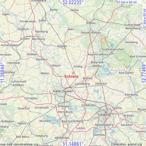
Schrenz GPS coordinates[2]
51° 35' 15.288" North, 12° 4' 17.616" East
| Map corner | latitude | longitude |
|---|---|---|
| Upper-left | 52.02235°, | 11.36844° |
| Center: | 51.58758°, | 12.07156° |
| Lower-right: | 51.14861°, | 12.77469° |
| Map W x H: | 97.2×97.1 km | = 60.4×60.3mi |
| max Lat: | 55.01917° ⇑32.5% North |
| Schrenz: | 51.58758° |
| min Lat: | ⇓67.5% South 47.40724° |
| min Long | Schrenz | max Long |
| 5.92978° | 12.07156° | 14.98853° |
| W 82.8%⇐ | ⇒17.2% E |
Elevation
Elevation of Schrenz is 91 m = 299 ft, and this is 158.1 m = 519 ft below average elevation for this country.
| Max E: |
1256 m = 4121 ft | 70% |
| Avg. | 249.1 m = 817 ft | |
| Schrenz | 91 m = 299 ft | |
Min E: |
-5 m = -16 ft | 30% |
See also: Germany elevation on elevation.city.
Geographical zone
Schrenz is located in North temperate zone (between Tropic of Cancer and the Arctic Circle). Distance of this North polar circle is 1665.2 km =1034.7 mi to North.| Distance of | km | miles | from Schrenz |
|---|---|---|---|
| North Pole | 4271.1 | 2653.9 | to North |
| Arctic Circle | 1665.2 | 1034.7 | to North |
| Tropic Cancer | 3130.1 | 1945 | to South |
| Equator | 5736 | 3564.2 | to South |


Nearby cities:
15 places around Schrenz: (largest is in red/bold)
• Brachstedt
2.3 km =1.4 mi,  216°
216°
• Braschwitz
7.3 km =4.5 mi,  187°
187°
• Großzöberitz
8.2 km =5.1 mi,  64°
64°
• Gutenberg
8.2 km =5.1 mi,  236°
236°
• Hohenthurm
7.9 km =4.9 mi,  166°
166°
• Niemberg
4.3 km =2.7 mi,  162°
162°
• Oppin
4.8 km =3 mi,  213°
213°
• Petersberg
8.2 km =5.1 mi,  276°
276°
• Radegast
7.8 km =4.8 mi,  11°
11°
• Schortewitz
7.9 km =4.9 mi,  335°
335°
• Schwerz
4.9 km =3 mi,  120°
120°
• Spickendorf
5.9 km =3.7 mi,  134°
134°
• Spören
3.9 km =2.4 mi,  65°
65°
• Stumsdorf
3.2 km =2 mi,  350°
350°
• Zörbig
5.6 km =3.5 mi,  34°
34°
Sources, notices
• [Note1] Compared only with cities in Germany existing in our database
• [Src1] Map data: © OpenStreetMap contributors (CC-BY-SA)
• [Src2] Other city data from geonames.org with taken over terms of usage.
• [Src3] Geographical zone / Annual Mean Temperature by Robert A. Rohde @ Wikipedia
