Schiesheim geodata
Schiesheim (Rheinland-Pfalz) is a seat of a fourth-order administrative division; located in Germany in Europe/Berlin (GMT+2) time zone. With population of 258 people, there are 10221 cities with bigger population in this country. Compared to other cities in Germany, 57.2% of cities are located further ↑North; 76.2% of cities are located further →East and 53.2% of cities have higher elevation than Schiesheim. Note1


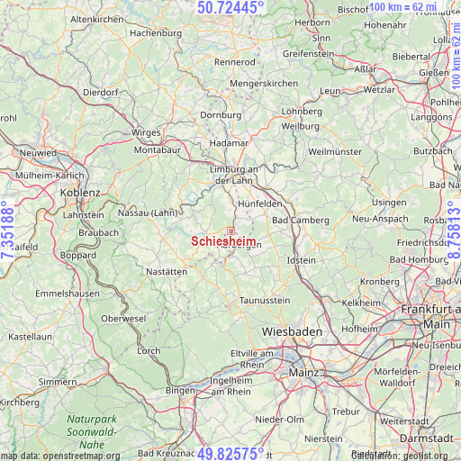
Schiesheim GPS coordinates[2]
50° 16' 37.992" North, 8° 3' 18" East
| Map corner | latitude | longitude |
|---|---|---|
| Upper-left | 50.72445°, | 7.35188° |
| Center: | 50.27722°, | 8.055° |
| Lower-right: | 49.82575°, | 8.75813° |
| Map W x H: | 99.9×99.9 km | = 62.1×62.1mi |
| max Lat: | 55.01917° ⇑57.2% North |
| Schiesheim: | 50.27722° |
| min Lat: | ⇓42.8% South 47.40724° |
| min Long | Schiesheim | max Long |
| 5.92978° | 8.055° | 14.98853° |
| W 23.8%⇐ | ⇒76.2% E |
Elevation
Elevation of Schiesheim is 202 m = 663 ft, and this is 47.1 m = 155 ft below average elevation for this country.
| Max E: |
1256 m = 4121 ft | 53.2% |
| Avg. | 249.1 m = 817 ft | |
| Schiesheim | 202 m = 663 ft | |
Min E: |
-5 m = -16 ft | 46.8% |
See also: Germany elevation on elevation.city.
Geographical zone
Schiesheim is located in North temperate zone (between Tropic of Cancer and the Arctic Circle). Distance of this North polar circle is 1810.9 km =1125.2 mi to North.| Distance of | km | miles | from Schiesheim |
|---|---|---|---|
| North Pole | 4416.8 | 2744.5 | to North |
| Arctic Circle | 1810.9 | 1125.2 | to North |
| Tropic Cancer | 2984.4 | 1854.4 | to South |
| Equator | 5590.3 | 3473.7 | to South |


Nearby cities:
15 places around Schiesheim: (largest is in red/bold)
• Allendorf
4.1 km =2.5 mi,  255°
255°
• Berghausen
4 km =2.5 mi,  239°
239°
• Burgschwalbach
2.1 km =1.3 mi,  71°
71°
• Dörsdorf
4.7 km =2.9 mi,  223°
223°
• Ebertshausen
5.1 km =3.2 mi,  277°
277°
• Eisighofen
5.6 km =3.5 mi,  209°
209°
• Hahnstätten
2.7 km =1.7 mi,  18°
18°
• Kaltenholzhausen
4.1 km =2.5 mi,  51°
51°
• Katzenelnbogen
5.9 km =3.7 mi, 259°
• Lohrheim
4.4 km =2.7 mi,  355°
355°
• Mudershausen
1.7 km =1.1 mi,  293°
293°
• Netzbach
5.4 km =3.4 mi,  36°
36°
• Oberneisen
5.6 km =3.5 mi, 16°
• Reckenroth
5.7 km =3.5 mi,  203°
203°
• Schönborn
5.2 km =3.2 mi,  302°
302°
Sources, notices
• [Note1] Compared only with cities in Germany existing in our database
• [Src1] Map data: © OpenStreetMap contributors (CC-BY-SA)
• [Src2] Other city data from geonames.org with taken over terms of usage.
• [Src3] Geographical zone / Annual Mean Temperature by Robert A. Rohde @ Wikipedia
