Burgschwalbach geodata
Burgschwalbach (Rheinland-Pfalz) is a seat of a fourth-order administrative division; located in Germany in Europe/Berlin (GMT+2) time zone. With population of 1,142 people, there are 6727 cities with bigger population in this country. Compared to other cities in Germany, 57.2% of cities are located further ↑North; 75.7% of cities are located further →East and 54.9% of cities have higher elevation than Burgschwalbach. Note1
Administrative division(s):
- Level 1: Rheinland-Pfalz
- Level 3: Rhein-Lahn-Kreis
- Level 4: Burgschwalbach


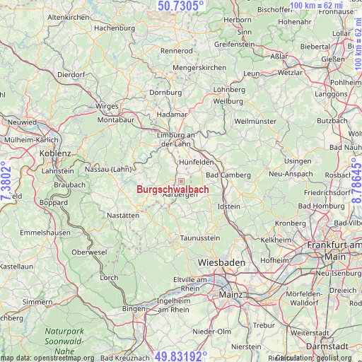
Burgschwalbach GPS coordinates[2]
50° 16' 59.988" North, 8° 4' 59.988" East
| Map corner | latitude | longitude |
|---|---|---|
| Upper-left | 50.7305°, | 7.3802° |
| Center: | 50.28333°, | 8.08333° |
| Lower-right: | 49.83192°, | 8.78645° |
| Map W x H: | 99.9×99.9 km | = 62.1×62.1mi |
| max Lat: | 55.01917° ⇑57.2% North |
| Burgschwalbach: | 50.28333° |
| min Lat: | ⇓42.8% South 47.40724° |
| min Long | Burgschwalbach | max Long |
| 5.92978° | 8.08333° | 14.98853° |
| W 24.3%⇐ | ⇒75.7% E |
Elevation
Elevation of Burgschwalbach is 190 m = 623 ft, and this is 59.1 m = 194 ft below average elevation for this country.
| Max E: |
1256 m = 4121 ft | 54.9% |
| Avg. | 249.1 m = 817 ft | |
| Burgschwalbach | 190 m = 623 ft | |
Min E: |
-5 m = -16 ft | 45.1% |
See also: Germany elevation on elevation.city.
Geographical zone
Burgschwalbach is located in North temperate zone (between Tropic of Cancer and the Arctic Circle). Distance of this North polar circle is 1810.2 km =1124.8 mi to North.| Distance of | km | miles | from Burgschwalbach |
|---|---|---|---|
| North Pole | 4416.1 | 2744 | to North |
| Arctic Circle | 1810.2 | 1124.8 | to North |
| Tropic Cancer | 2985.1 | 1854.9 | to South |
| Equator | 5591 | 3474.1 | to South |


Nearby cities:
15 places around Burgschwalbach: (largest is in red/bold)
• Allendorf
6.2 km =3.9 mi,  253°
253°
• Berghausen
6.1 km =3.8 mi,  243°
243°
• Dörsdorf
6.7 km =4.2 mi,  231°
231°
• Ebertshausen
7.1 km =4.4 mi,  270°
270°
• Eisighofen
7.3 km =4.5 mi,  220°
220°
• Hahnstätten
2.2 km =1.4 mi,  327°
327°
• Kaltenholzhausen
2.2 km =1.4 mi,  32°
32°
• Lohrheim
4.4 km =2.7 mi, 327°
• Mudershausen
3.6 km =2.2 mi, 270°
• Netzbach
3.9 km =2.4 mi,  17°
17°
• Niederneisen
6 km =3.7 mi,  336°
336°
• Oberneisen
4.7 km =2.9 mi,  354°
354°
• Reckenroth
7.3 km =4.5 mi, 215°
• Schiesheim
2.1 km =1.3 mi, 251°
• Schönborn
6.7 km =4.2 mi,  288°
288°
Sources, notices
• [Note1] Compared only with cities in Germany existing in our database
• [Src1] Map data: © OpenStreetMap contributors (CC-BY-SA)
• [Src2] Other city data from geonames.org with taken over terms of usage.
• [Src3] Geographical zone / Annual Mean Temperature by Robert A. Rohde @ Wikipedia
