Ruhmannsfelden geodata
Ruhmannsfelden (Bavaria) is a populated place; located in Germany in Europe/Berlin (GMT+2) time zone. With population of 2,190 people, there are 4818 cities with bigger population in this country. Compared to other cities in Germany, 83.2% of cities are located further ↑North; 92.2% of cities are located further ←West and 91.2% of cities have lower elevation than Ruhmannsfelden. Note1
Administrative division(s):
- Level 1: Bavaria
- Level 2: Lower Bavaria
- Level 3: Landkreis Regen
- Level 4: Ruhmannsfelden, Markt


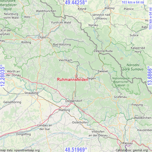
Ruhmannsfelden GPS coordinates[2]
48° 58' 59.772" North, 12° 59' 0.492" East
| Map corner | latitude | longitude |
|---|---|---|
| Upper-left | 49.44258°, | 12.28035° |
| Center: | 48.98327°, | 12.98347° |
| Lower-right: | 48.51969°, | 13.6866° |
| Map W x H: | 102.6×102.6 km | = 63.8×63.8mi |
| max Lat: | 55.01917° ⇑83.2% North |
| Ruhmannsfelden: | 48.98327° |
| min Lat: | ⇓16.8% South 47.40724° |
| min Long | Ruhmannsfelden | max Long |
| 5.92978° | 12.98347° | 14.98853° |
| W 92.2%⇐ | ⇒7.8% E |
Elevation
Elevation of Ruhmannsfelden is 530 m = 1739 ft, and this is 280.9 m = 922 ft above average elevation for this country.
| Max E: |
1256 m = 4121 ft | 8.8% |
| Ruhmannsfelden | 530 m 1739 ft | |
| Avg. | 249.1 m = 817 ft | |
Min E: |
-5 m = -16 ft | 91.2% |
See also: Germany elevation on elevation.city.
Geographical zone
Ruhmannsfelden is located in North temperate zone (between Tropic of Cancer and the Arctic Circle). Distance of this North polar circle is 1954.7 km =1214.6 mi to North.| Distance of | km | miles | from Ruhmannsfelden |
|---|---|---|---|
| North Pole | 4560.6 | 2833.8 | to North |
| Arctic Circle | 1954.7 | 1214.6 | to North |
| Tropic Cancer | 2840.5 | 1765 | to South |
| Equator | 5446.4 | 3384.2 | to South |


Nearby cities:
15 places around Ruhmannsfelden: (largest is in red/bold)
• Achslach
3.8 km =2.4 mi,  249°
249°
• Bernried
10.4 km =6.5 mi,  224°
224°
• Bischofsmais
10.2 km =6.3 mi,  135°
135°
• Böbrach
8.9 km =5.5 mi,  24°
24°
• Böbrach
9.2 km =5.7 mi,  232°
232°
• Geiersthal
6.9 km =4.3 mi,  358°
358°
• Gotteszell
2.2 km =1.4 mi,  213°
213°
• Grafling
9.8 km =6.1 mi,  183°
183°
• Kollnburg
11.4 km =7.1 mi,  308°
308°
• Langdorf
12.4 km =7.7 mi,  73°
73°
• Patersdorf
3.7 km =2.3 mi, 359°
• Regen
10.6 km =6.6 mi,  96°
96°
• Sankt Englmar
11.7 km =7.3 mi,  280°
280°
• Teisnach
6.4 km =4 mi,  2°
2°
• Zachenberg
2.2 km =1.4 mi,  146°
146°
Sources, notices
• [Note1] Compared only with cities in Germany existing in our database
• [Src1] Map data: © OpenStreetMap contributors (CC-BY-SA)
• [Src2] Other city data from geonames.org with taken over terms of usage.
• [Src3] Geographical zone / Annual Mean Temperature by Robert A. Rohde @ Wikipedia
