Rotthalmünster geodata
Rotthalmünster (Bavaria) is a populated place; located in Germany in Europe/Berlin (GMT+2) time zone. With population of 5,115 people, there are 2782 cities with bigger population in this country. Compared to other cities in Germany, 90.6% of cities are located further ↑North; 93.7% of cities are located further ←West and 71.5% of cities have lower elevation than Rotthalmünster. Note1
Administrative division(s):
- Level 1: Bavaria
- Level 2: Lower Bavaria
- Level 3: Landkreis Passau
- Level 4: Rotthalmünster, Markt


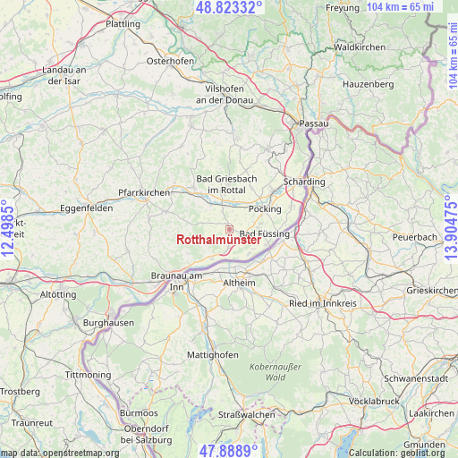
Rotthalmünster GPS coordinates[2]
48° 21' 29.7" North, 13° 12' 5.832" East
| Map corner | latitude | longitude |
|---|---|---|
| Upper-left | 48.82332°, | 12.4985° |
| Center: | 48.35825°, | 13.20162° |
| Lower-right: | 47.8889°, | 13.90475° |
| Map W x H: | 103.9×103.9 km | = 64.6×64.6mi |
| max Lat: | 55.01917° ⇑90.6% North |
| Rotthalmünster: | 48.35825° |
| min Lat: | ⇓9.4% South 47.40724° |
| min Long | Rotthalmünster | max Long |
| 5.92978° | 13.20162° | 14.98853° |
| W 93.7%⇐ | ⇒6.3% E |
Elevation
Elevation of Rotthalmünster is 370 m = 1214 ft, and this is 120.9 m = 397 ft above average elevation for this country.
| Max E: |
1256 m = 4121 ft | 28.5% |
| Rotthalmünster | 370 m 1214 ft | |
| Avg. | 249.1 m = 817 ft | |
Min E: |
-5 m = -16 ft | 71.5% |
See also: Germany elevation on elevation.city.
Geographical zone
Rotthalmünster is located in North temperate zone (between Tropic of Cancer and the Arctic Circle). Distance of this North polar circle is 2024.2 km =1257.8 mi to North.| Distance of | km | miles | from Rotthalmünster |
|---|---|---|---|
| North Pole | 4630.1 | 2877 | to North |
| Arctic Circle | 2024.2 | 1257.8 | to North |
| Tropic Cancer | 2771 | 1721.8 | to South |
| Equator | 5376.9 | 3341 | to South |


Nearby cities:
15 places around Rotthalmünster: (largest is in red/bold)
• Bad Birnbach
12.6 km =7.8 mi,  319°
319°
• Bad Füssing
8.2 km =5.1 mi,  95°
95°
• Bad Griesbach
10.4 km =6.5 mi,  356°
356°
• Bayerbach
7.2 km =4.5 mi, 323°
• Chostlarn
6.2 km =3.9 mi,  283°
283°
• Ering
7.6 km =4.7 mi,  210°
210°
• Haarbach
16.2 km =10.1 mi,  346°
346°
• Kirchham
5 km =3.1 mi,  105°
105°
• Malching
5.2 km =3.2 mi,  191°
191°
• Pocking
9.5 km =5.9 mi,  59°
59°
• Simbach am Inn
16.8 km =10.4 mi,  231°
231°
• Stubenberg
9.9 km =6.2 mi,  242°
242°
• Tettenweis
10.7 km =6.6 mi,  28°
28°
• Triftern
15 km =9.3 mi,  285°
285°
• Wittibreut
16.2 km =10.1 mi,  258°
258°
Sources, notices
• [Note1] Compared only with cities in Germany existing in our database
• [Src1] Map data: © OpenStreetMap contributors (CC-BY-SA)
• [Src2] Other city data from geonames.org with taken over terms of usage.
• [Src3] Geographical zone / Annual Mean Temperature by Robert A. Rohde @ Wikipedia
