Chostlarn geodata
Chostlarn (Bavaria) is a populated place; located in Germany in Europe/Berlin (GMT+2) time zone. With population of 1,941 people, there are 5150 cities with bigger population in this country. Compared to other cities in Germany, 90.5% of cities are located further ↑North; 93.1% of cities are located further ←West and 79.7% of cities have lower elevation than Chostlarn. Note1
Administrative division(s):
- Level 1: Bavaria
- Level 2: Lower Bavaria
- Level 3: Landkreis Passau
- Level 4: Kößlarn, Markt


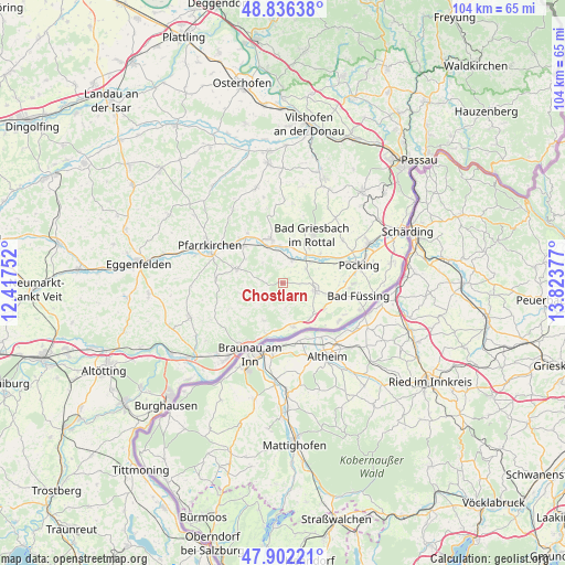
Chostlarn GPS coordinates[2]
48° 22' 17.184" North, 13° 7' 14.304" East
| Map corner | latitude | longitude |
|---|---|---|
| Upper-left | 48.83638°, | 12.41752° |
| Center: | 48.37144°, | 13.12064° |
| Lower-right: | 47.90221°, | 13.82377° |
| Map W x H: | 103.9×103.9 km | = 64.6×64.6mi |
| max Lat: | 55.01917° ⇑90.5% North |
| Chostlarn: | 48.37144° |
| min Lat: | ⇓9.5% South 47.40724° |
| min Long | Chostlarn | max Long |
| 5.92978° | 13.12064° | 14.98853° |
| W 93.1%⇐ | ⇒6.9% E |
Elevation
Elevation of Chostlarn is 431 m = 1414 ft, and this is 181.9 m = 597 ft above average elevation for this country.
| Max E: |
1256 m = 4121 ft | 20.3% |
| Chostlarn | 431 m 1414 ft | |
| Avg. | 249.1 m = 817 ft | |
Min E: |
-5 m = -16 ft | 79.7% |
See also: Germany elevation on elevation.city.
Geographical zone
Chostlarn is located in North temperate zone (between Tropic of Cancer and the Arctic Circle). Distance of this North polar circle is 2022.8 km =1256.9 mi to North.| Distance of | km | miles | from Chostlarn |
|---|---|---|---|
| North Pole | 4628.7 | 2876.1 | to North |
| Arctic Circle | 2022.8 | 1256.9 | to North |
| Tropic Cancer | 2772.5 | 1722.8 | to South |
| Equator | 5378.4 | 3342 | to South |


Nearby cities:
15 places around Chostlarn: (largest is in red/bold)
• Bad Birnbach
8.5 km =5.3 mi,  345°
345°
• Bad Füssing
14.3 km =8.9 mi,  99°
99°
• Bad Griesbach
10.4 km =6.5 mi,  30°
30°
• Bayerbach
4.6 km =2.9 mi,  21°
21°
• Ering
8.3 km =5.2 mi,  164°
164°
• Haarbach
14.5 km =9 mi,  8°
8°
• Kirchham
11.2 km =7 mi, 104°
• Malching
8.2 km =5.1 mi,  143°
143°
• Pocking
14.6 km =9.1 mi,  76°
76°
• Rotthalmünster
6.2 km =3.9 mi, 103°
• Simbach am Inn
13.8 km =8.6 mi,  211°
211°
• Stubenberg
6.7 km =4.2 mi,  204°
204°
• Tettenweis
13.6 km =8.5 mi,  54°
54°
• Triftern
8.8 km =5.5 mi,  287°
287°
• Wittibreut
10.9 km =6.8 mi,  244°
244°
Sources, notices
• [Note1] Compared only with cities in Germany existing in our database
• [Src1] Map data: © OpenStreetMap contributors (CC-BY-SA)
• [Src2] Other city data from geonames.org with taken over terms of usage.
• [Src3] Geographical zone / Annual Mean Temperature by Robert A. Rohde @ Wikipedia
