Roßdorf geodata
Roßdorf (Thuringia) is a seat of a fourth-order administrative division; located in Germany in Europe/Berlin (GMT+2) time zone. With population of 716 people, there are 8248 cities with bigger population in this country. Compared to other cities in Germany, 52% of cities are located further ↓South; 53.6% of cities are located further ←West and 75.7% of cities have lower elevation than Roßdorf. Note1
Administrative division(s):
- Level 1: Thuringia
- Level 3: Landkreis Schmalkalden-Meiningen
- Level 4: Roßdorf


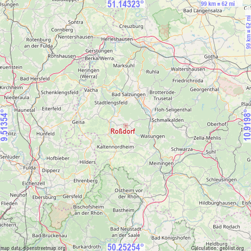
Roßdorf GPS coordinates[2]
50° 42' 0" North, 10° 13' 0.012" East
| Map corner | latitude | longitude |
|---|---|---|
| Upper-left | 51.14323°, | 9.51354° |
| Center: | 50.7°, | 10.21667° |
| Lower-right: | 50.25254°, | 10.9198° |
| Map W x H: | 99×99 km | = 61.5×61.5mi |
| max Lat: | 55.01917° ⇑48% North |
| Roßdorf: | 50.7° |
| min Lat: | ⇓52% South 47.40724° |
| min Long | Roßdorf | max Long |
| 5.92978° | 10.21667° | 14.98853° |
| W 53.6%⇐ | ⇒46.4% E |
Elevation
Elevation of Roßdorf is 403 m = 1322 ft, and this is 153.9 m = 505 ft above average elevation for this country.
| Max E: |
1256 m = 4121 ft | 24.3% |
| Roßdorf | 403 m 1322 ft | |
| Avg. | 249.1 m = 817 ft | |
Min E: |
-5 m = -16 ft | 75.7% |
See also: Germany elevation on elevation.city.
Geographical zone
Roßdorf is located in North temperate zone (between Tropic of Cancer and the Arctic Circle). Distance of this North polar circle is 1763.9 km =1096 mi to North.| Distance of | km | miles | from Roßdorf |
|---|---|---|---|
| North Pole | 4369.8 | 2715.3 | to North |
| Arctic Circle | 1763.9 | 1096 | to North |
| Tropic Cancer | 3031.4 | 1883.6 | to South |
| Equator | 5637.3 | 3502.9 | to South |


Nearby cities:
15 places around Roßdorf: (largest is in red/bold)
• Dermbach
7.1 km =4.4 mi,  282°
282°
• Empfertshausen
9 km =5.6 mi,  245°
245°
• Friedelshausen
4.9 km =3 mi,  163°
163°
• Hümpfershausen
3.9 km =2.4 mi, 162°
• Kaltenlengsfeld
6.8 km =4.2 mi,  194°
194°
• Kaltennordheim
9.1 km =5.7 mi,  206°
206°
• Klings
9 km =5.6 mi,  231°
231°
• Neidhartshausen
6.2 km =3.9 mi, 252°
• Oepfershausen
6.8 km =4.2 mi,  165°
165°
• Rosa
2.7 km =1.7 mi,  60°
60°
• Unterkatz
9.4 km =5.8 mi, 162°
• Urnshausen
4.9 km =3 mi,  322°
322°
• Wahns
9.5 km =5.9 mi,  141°
141°
• Weilar
8.8 km =5.5 mi,  327°
327°
• Wiesenthal
3.5 km =2.2 mi,  270°
270°
Sources, notices
• [Note1] Compared only with cities in Germany existing in our database
• [Src1] Map data: © OpenStreetMap contributors (CC-BY-SA)
• [Src2] Other city data from geonames.org with taken over terms of usage.
• [Src3] Geographical zone / Annual Mean Temperature by Robert A. Rohde @ Wikipedia
