Rosa geodata
Rosa (Thuringia) is a seat of a fourth-order administrative division; located in Germany in Europe/Berlin (GMT+2) time zone. With population of 826 people, there are 7794 cities with bigger population in this country. Compared to other cities in Germany, 52.4% of cities are located further ↓South; 54.3% of cities are located further ←West and 68.9% of cities have lower elevation than Rosa. Note1
Administrative division(s):
- Level 1: Thuringia
- Level 3: Landkreis Schmalkalden-Meiningen
- Level 4: Rosa


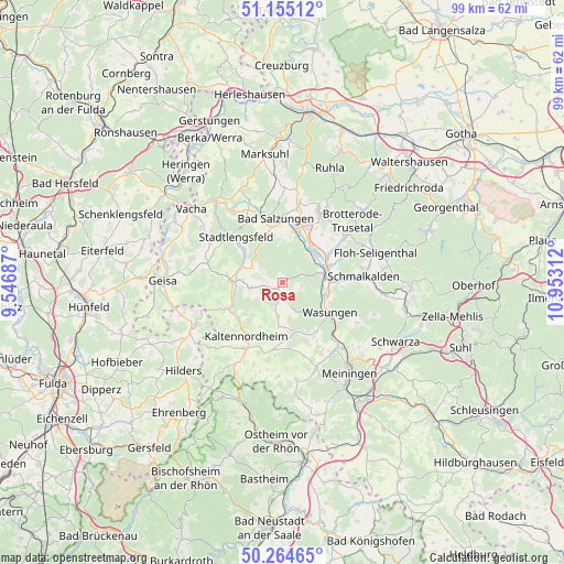
Rosa GPS coordinates[2]
50° 42' 43.2" North, 10° 14' 59.964" East
| Map corner | latitude | longitude |
|---|---|---|
| Upper-left | 51.15512°, | 9.54687° |
| Center: | 50.712°, | 10.24999° |
| Lower-right: | 50.26465°, | 10.95312° |
| Map W x H: | 99×99 km | = 61.5×61.5mi |
| max Lat: | 55.01917° ⇑47.6% North |
| Rosa: | 50.712° |
| min Lat: | ⇓52.4% South 47.40724° |
| min Long | Rosa | max Long |
| 5.92978° | 10.24999° | 14.98853° |
| W 54.3%⇐ | ⇒45.7% E |
Elevation
Elevation of Rosa is 350 m = 1148 ft, and this is 100.9 m = 331 ft above average elevation for this country.
| Max E: |
1256 m = 4121 ft | 31.1% |
| Rosa | 350 m 1148 ft | |
| Avg. | 249.1 m = 817 ft | |
Min E: |
-5 m = -16 ft | 68.9% |
See also: Germany elevation on elevation.city.
Geographical zone
Rosa is located in North temperate zone (between Tropic of Cancer and the Arctic Circle). Distance of this North polar circle is 1762.5 km =1095.2 mi to North.| Distance of | km | miles | from Rosa |
|---|---|---|---|
| North Pole | 4368.4 | 2714.4 | to North |
| Arctic Circle | 1762.5 | 1095.2 | to North |
| Tropic Cancer | 3032.7 | 1884.4 | to South |
| Equator | 5638.6 | 3503.7 | to South |


Nearby cities:
15 places around Rosa: (largest is in red/bold)
• Breitungen
7.9 km =4.9 mi,  43°
43°
• Dermbach
9.3 km =5.8 mi,  271°
271°
• Fambach
8.5 km =5.3 mi,  73°
73°
• Friedelshausen
6.1 km =3.8 mi,  188°
188°
• Hümpfershausen
5.2 km =3.2 mi, 193°
• Immelborn
9.1 km =5.7 mi,  12°
12°
• Kaltenlengsfeld
8.9 km =5.5 mi,  207°
207°
• Neidhartshausen
8.8 km =5.5 mi,  248°
248°
• Oepfershausen
7.9 km =4.9 mi,  184°
184°
• Roßdorf
2.7 km =1.7 mi,  240°
240°
• Schwallungen
7.8 km =4.8 mi,  105°
105°
• Urnshausen
5.9 km =3.7 mi,  295°
295°
• Weilar
9.3 km =5.8 mi,  310°
310°
• Wernshausen
7.2 km =4.5 mi,  79°
79°
• Wiesenthal
6 km =3.7 mi,  257°
257°
Sources, notices
• [Note1] Compared only with cities in Germany existing in our database
• [Src1] Map data: © OpenStreetMap contributors (CC-BY-SA)
• [Src2] Other city data from geonames.org with taken over terms of usage.
• [Src3] Geographical zone / Annual Mean Temperature by Robert A. Rohde @ Wikipedia
