Urnshausen geodata
Urnshausen (Thuringia) is a seat of a fourth-order administrative division; located in Germany in Europe/Berlin (GMT+2) time zone. With population of 801 people, there are 7893 cities with bigger population in this country. Compared to other cities in Germany, 53% of cities are located further ↓South; 52.9% of cities are located further ←West and 67.2% of cities have lower elevation than Urnshausen. Note1


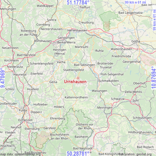
Urnshausen GPS coordinates[2]
50° 44' 5.784" North, 10° 10' 25.716" East
| Map corner | latitude | longitude |
|---|---|---|
| Upper-left | 51.17784°, | 9.47069° |
| Center: | 50.73494°, | 10.17381° |
| Lower-right: | 50.28781°, | 10.87694° |
| Map W x H: | 99×99 km | = 61.5×61.5mi |
| max Lat: | 55.01917° ⇑47% North |
| Urnshausen: | 50.73494° |
| min Lat: | ⇓53% South 47.40724° |
| min Long | Urnshausen | max Long |
| 5.92978° | 10.17381° | 14.98853° |
| W 52.9%⇐ | ⇒47.1% E |
Elevation
Elevation of Urnshausen is 337 m = 1106 ft, and this is 87.9 m = 288 ft above average elevation for this country.
| Max E: |
1256 m = 4121 ft | 32.8% |
| Urnshausen | 337 m 1106 ft | |
| Avg. | 249.1 m = 817 ft | |
Min E: |
-5 m = -16 ft | 67.2% |
See also: Germany elevation on elevation.city.
Geographical zone
Urnshausen is located in North temperate zone (between Tropic of Cancer and the Arctic Circle). Distance of this North polar circle is 1760 km =1093.6 mi to North.| Distance of | km | miles | from Urnshausen |
|---|---|---|---|
| North Pole | 4365.9 | 2712.8 | to North |
| Arctic Circle | 1760 | 1093.6 | to North |
| Tropic Cancer | 3035.3 | 1886 | to South |
| Equator | 5641.2 | 3505.3 | to South |


Nearby cities:
15 places around Urnshausen: (largest is in red/bold)
• Bad Salzungen
9.8 km =6.1 mi,  26°
26°
• Dermbach
4.6 km =2.9 mi,  238°
238°
• Empfertshausen
9.2 km =5.7 mi,  214°
214°
• Friedelshausen
9.7 km =6 mi,  152°
152°
• Hümpfershausen
8.7 km =5.4 mi, 151°
• Immelborn
9.7 km =6 mi,  49°
49°
• Leimbach
9.3 km =5.8 mi,  11°
11°
• Neidhartshausen
6.4 km =4 mi, 206°
• Oechsen
7.9 km =4.9 mi,  278°
278°
• Rosa
5.9 km =3.7 mi,  115°
115°
• Roßdorf
4.9 km =3 mi,  142°
142°
• Stadtlengsfeld
6.2 km =3.9 mi,  329°
329°
• Weilar
3.9 km =2.4 mi, 334°
• Wiesenthal
3.9 km =2.4 mi,  187°
187°
• Wölferbütt
9.4 km =5.8 mi,  292°
292°
Sources, notices
• [Note1] Compared only with cities in Germany existing in our database
• [Src1] Map data: © OpenStreetMap contributors (CC-BY-SA)
• [Src2] Other city data from geonames.org with taken over terms of usage.
• [Src3] Geographical zone / Annual Mean Temperature by Robert A. Rohde @ Wikipedia
