Rosenthal geodata
Rosenthal (Hesse) is a populated place; located in Germany in Europe/Berlin (GMT+2) time zone. With population of 2,209 people, there are 4790 cities with bigger population in this country. Compared to other cities in Germany, 57.7% of cities are located further ↓South; 67% of cities are located further →East and 57.6% of cities have lower elevation than Rosenthal. Note1
Administrative division(s):
- Level 1: Hesse
- Level 2: Regierungsbezirk Kassel
- Level 3: Landkreis Waldeck-Frankenberg
- Level 4: Rosenthal


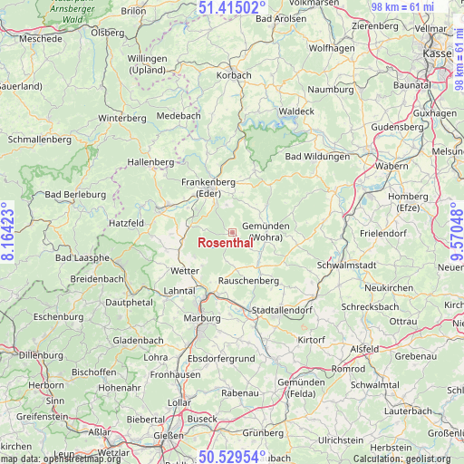
Rosenthal GPS coordinates[2]
50° 58' 27.804" North, 8° 52' 2.496" East
| Map corner | latitude | longitude |
|---|---|---|
| Upper-left | 51.41502°, | 8.16423° |
| Center: | 50.97439°, | 8.86736° |
| Lower-right: | 50.52954°, | 9.57048° |
| Map W x H: | 98.5×98.5 km | = 61.2×61.2mi |
| max Lat: | 55.01917° ⇑42.3% North |
| Rosenthal: | 50.97439° |
| min Lat: | ⇓57.7% South 47.40724° |
| min Long | Rosenthal | max Long |
| 5.92978° | 8.86736° | 14.98853° |
| W 33%⇐ | ⇒67% E |
Elevation
Elevation of Rosenthal is 276 m = 906 ft, and this is 26.9 m = 88 ft above average elevation for this country.
| Max E: |
1256 m = 4121 ft | 42.4% |
| Rosenthal | 276 m 906 ft | |
| Avg. | 249.1 m = 817 ft | |
Min E: |
-5 m = -16 ft | 57.6% |
See also: Germany elevation on elevation.city.
Geographical zone
Rosenthal is located in North temperate zone (between Tropic of Cancer and the Arctic Circle). Distance of this North polar circle is 1733.4 km =1077.1 mi to North.| Distance of | km | miles | from Rosenthal |
|---|---|---|---|
| North Pole | 4339.2 | 2696.3 | to North |
| Arctic Circle | 1733.4 | 1077.1 | to North |
| Tropic Cancer | 3061.9 | 1902.6 | to South |
| Equator | 5667.8 | 3521.8 | to South |


Nearby cities:
15 places around Rosenthal: (largest is in red/bold)
• Allendorf
15 km =9.3 mi,  294°
294°
• Battenberg
16.1 km =10 mi, 285°
• Cölbe
15 km =9.3 mi,  203°
203°
• Frankenau
14 km =8.7 mi,  19°
19°
• Frankenberg
10.5 km =6.5 mi,  333°
333°
• Gemünden an der Wohra
7.1 km =4.4 mi,  90°
90°
• Gilserberg
14.2 km =8.8 mi,  100°
100°
• Haina
9.6 km =6 mi,  51°
51°
• Jesberg
20 km =12.4 mi,  81°
81°
• Kirchhain
16.9 km =10.5 mi,  165°
165°
• Marburg an der Lahn
19.6 km =12.2 mi, 200°
• Münchhausen
10.5 km =6.5 mi,  261°
261°
• Rauschenberg
10.7 km =6.6 mi,  160°
160°
• Stadtallendorf
19.7 km =12.2 mi,  148°
148°
• Wetter
12.9 km =8 mi,  231°
231°
Sources, notices
• [Note1] Compared only with cities in Germany existing in our database
• [Src1] Map data: © OpenStreetMap contributors (CC-BY-SA)
• [Src2] Other city data from geonames.org with taken over terms of usage.
• [Src3] Geographical zone / Annual Mean Temperature by Robert A. Rohde @ Wikipedia
