Regesbostel geodata
Regesbostel (Lower Saxony) is a seat of a fourth-order administrative division; located in Germany in Europe/Berlin (GMT+2) time zone. With population of 1,063 people, there are 6955 cities with bigger population in this country. Compared to other cities in Germany, 84.4% of cities are located further ↓South; 55.3% of cities are located further →East and 80.6% of cities have higher elevation than Regesbostel. Note1


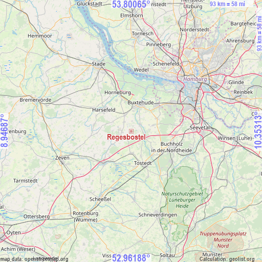
Regesbostel GPS coordinates[2]
53° 22' 59.988" North, 9° 39' 0" East
| Map corner | latitude | longitude |
|---|---|---|
| Upper-left | 53.80065°, | 8.94687° |
| Center: | 53.38333°, | 9.65° |
| Lower-right: | 52.96188°, | 10.35313° |
| Map W x H: | 93.3×93.3 km | = 58×58mi |
| max Lat: | 55.01917° ⇑15.6% North |
| Regesbostel: | 53.38333° |
| min Lat: | ⇓84.4% South 47.40724° |
| min Long | Regesbostel | max Long |
| 5.92978° | 9.65° | 14.98853° |
| W 44.7%⇐ | ⇒55.3% E |
Elevation
Elevation of Regesbostel is 45 m = 148 ft, and this is 204.1 m = 670 ft below average elevation for this country.
| Max E: |
1256 m = 4121 ft | 80.6% |
| Avg. | 249.1 m = 817 ft | |
| Regesbostel | 45 m = 148 ft | |
Min E: |
-5 m = -16 ft | 19.4% |
See also: Germany elevation on elevation.city.
Geographical zone
Regesbostel is located in North temperate zone (between Tropic of Cancer and the Arctic Circle). Distance of this North polar circle is 1465.5 km =910.6 mi to North.| Distance of | km | miles | from Regesbostel |
|---|---|---|---|
| North Pole | 4071.4 | 2529.8 | to North |
| Arctic Circle | 1465.5 | 910.6 | to North |
| Tropic Cancer | 3329.8 | 2069 | to South |
| Equator | 5935.7 | 3688.3 | to South |


Nearby cities:
15 places around Regesbostel: (largest is in red/bold)
• Apensen
6 km =3.7 mi,  338°
338°
• Appel
6.4 km =4 mi,  82°
82°
• Beckdorf
4.3 km =2.7 mi,  329°
329°
• Buxtehude
9.6 km =6 mi,  14°
14°
• Dohren
9.8 km =6.1 mi,  160°
160°
• Drestedt
9.2 km =5.7 mi,  129°
129°
• Halvesbostel
4.6 km =2.9 mi,  227°
227°
• Heidenau
7.5 km =4.7 mi,  171°
171°
• Hollenstedt
4.8 km =3 mi,  112°
112°
• Kakenstorf
11.6 km =7.2 mi,  139°
139°
• Moisburg
4.1 km =2.5 mi,  51°
51°
• Sauensiek
3.3 km =2.1 mi,  270°
270°
• Vierden
11.4 km =7.1 mi,  240°
240°
• Wenzendorf
8.9 km =5.5 mi, 114°
• Wohnste
8.6 km =5.3 mi, 244°
Sources, notices
• [Note1] Compared only with cities in Germany existing in our database
• [Src1] Map data: © OpenStreetMap contributors (CC-BY-SA)
• [Src2] Other city data from geonames.org with taken over terms of usage.
• [Src3] Geographical zone / Annual Mean Temperature by Robert A. Rohde @ Wikipedia
