Radis geodata
Radis (Saxony-Anhalt) is a populated place; located in Germany in Europe/Berlin (GMT+2) time zone. With population of 1,342 people, there are 6198 cities with bigger population in this country. Compared to other cities in Germany, 69.4% of cities are located further ↓South; 88.1% of cities are located further ←West and 68.7% of cities have higher elevation than Radis. Note1


Radis GPS coordinates[2]
51° 45' 8.136" North, 12° 30' 52.308" East
| Map corner | latitude | longitude |
|---|---|---|
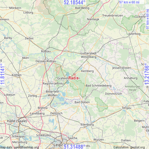
| Upper-left | 52.18544°, | 11.81141° |
| Center: | 51.75226°, | 12.51453° |
| Lower-right: | 51.31488°, | 13.21766° |
| Map W x H: | 96.8×96.8 km | = 60.1×60.1mi |
| max Lat: | 55.01917° ⇑30.6% North |
| Radis: | 51.75226° |
| min Lat: | ⇓69.4% South 47.40724° |
| min Long | Radis | max Long |
| 5.92978° | 12.51453° | 14.98853° |
| W 88.1%⇐ | ⇒11.9% E |
Elevation
Elevation of Radis is 99 m = 325 ft, and this is 150.1 m = 492 ft below average elevation for this country.
| Max E: |
1256 m = 4121 ft | 68.7% |
| Avg. | 249.1 m = 817 ft | |
| Radis | 99 m = 325 ft | |
Min E: |
-5 m = -16 ft | 31.3% |
See also: Germany elevation on elevation.city.
Geographical zone
Radis is located in North temperate zone (between Tropic of Cancer and the Arctic Circle). Distance of this North polar circle is 1646.9 km =1023.3 mi to North.| Distance of | km | miles | from Radis |
|---|---|---|---|
| North Pole | 4252.8 | 2642.6 | to North |
| Arctic Circle | 1646.9 | 1023.3 | to North |
| Tropic Cancer | 3148.4 | 1956.3 | to South |
| Equator | 5754.3 | 3575.6 | to South |


Nearby cities:
15 places around Radis: (largest is in red/bold)
• Ateritz
8.2 km =5.1 mi,  100°
100°
• Bergwitz
7 km =4.3 mi,  47°
47°
• Burgkemnitz
10.9 km =6.8 mi,  225°
225°
• Gossa
10.4 km =6.5 mi,  207°
207°
• Gräfenhainichen
4.8 km =3 mi,  236°
236°
• Gröbern
8.3 km =5.2 mi, 211°
• Horstdorf
9.5 km =5.9 mi,  321°
321°
• Jüdenberg
6.9 km =4.3 mi,  268°
268°
• Kakau
8.1 km =5 mi, 315°
• Kemberg
8.4 km =5.2 mi,  74°
74°
• Oranienbaum
9.1 km =5.7 mi,  304°
304°
• Rotta
6.2 km =3.9 mi,  77°
77°
• Schköna
8.1 km =5 mi,  168°
168°
• Schleesen
4 km =2.5 mi,  332°
332°
• Zschornewitz
8.9 km =5.5 mi, 242°
Sources, notices
• [Note1] Compared only with cities in Germany existing in our database
• [Src1] Map data: © OpenStreetMap contributors (CC-BY-SA)
• [Src2] Other city data from geonames.org with taken over terms of usage.
• [Src3] Geographical zone / Annual Mean Temperature by Robert A. Rohde @ Wikipedia
