Quellendorf geodata
Quellendorf (Saxony-Anhalt) is a populated place; located in Germany in Europe/Berlin (GMT+2) time zone. With population of 1,033 people, there are 7071 cities with bigger population in this country. Compared to other cities in Germany, 69.4% of cities are located further ↓South; 83.5% of cities are located further ←West and 71.7% of cities have higher elevation than Quellendorf. Note1
Administrative division(s):
- Level 1: Saxony-Anhalt
- Level 3: Anhalt-Bitterfeld
- Level 4: Südliches Anhalt


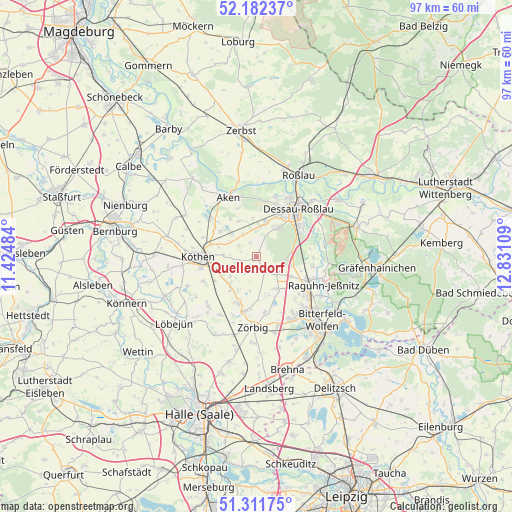
Quellendorf GPS coordinates[2]
51° 44' 56.976" North, 12° 7' 40.656" East
| Map corner | latitude | longitude |
|---|---|---|
| Upper-left | 52.18237°, | 11.42484° |
| Center: | 51.74916°, | 12.12796° |
| Lower-right: | 51.31175°, | 12.83109° |
| Map W x H: | 96.8×96.8 km | = 60.1×60.1mi |
| max Lat: | 55.01917° ⇑30.6% North |
| Quellendorf: | 51.74916° |
| min Lat: | ⇓69.4% South 47.40724° |
| min Long | Quellendorf | max Long |
| 5.92978° | 12.12796° | 14.98853° |
| W 83.5%⇐ | ⇒16.5% E |
Elevation
Elevation of Quellendorf is 80 m = 262 ft, and this is 169.1 m = 555 ft below average elevation for this country.
| Max E: |
1256 m = 4121 ft | 71.7% |
| Avg. | 249.1 m = 817 ft | |
| Quellendorf | 80 m = 262 ft | |
Min E: |
-5 m = -16 ft | 28.3% |
See also: Germany elevation on elevation.city.
Geographical zone
Quellendorf is located in North temperate zone (between Tropic of Cancer and the Arctic Circle). Distance of this North polar circle is 1647.2 km =1023.5 mi to North.| Distance of | km | miles | from Quellendorf |
|---|---|---|---|
| North Pole | 4253.1 | 2642.8 | to North |
| Arctic Circle | 1647.2 | 1023.5 | to North |
| Tropic Cancer | 3148 | 1956.1 | to South |
| Equator | 5754 | 3575.4 | to South |


Nearby cities:
15 places around Quellendorf: (largest is in red/bold)
• Bobbau
12.1 km =7.5 mi,  124°
124°
• Elsnigk
6.8 km =4.2 mi,  313°
313°
• Großbadegast
7.2 km =4.5 mi,  254°
254°
• Hinsdorf
3.4 km =2.1 mi,  150°
150°
• Köthen
10.8 km =6.7 mi,  271°
271°
• Löberitz
10.7 km =6.6 mi,  173°
173°
• Osternienburg
8.6 km =5.3 mi, 305°
• Osternienburger Land
9.5 km =5.9 mi, 306°
• Prosigk
7.4 km =4.6 mi,  222°
222°
• Radegast
10.5 km =6.5 mi,  192°
192°
• Raguhn
11 km =6.8 mi,  112°
112°
• Salzfurtkapelle
7 km =4.3 mi, 150°
• Schierau
10.7 km =6.6 mi,  90°
90°
• Tornau
5 km =3.1 mi,  132°
132°
• Weißandt-Gölzau
9.5 km =5.9 mi,  203°
203°
Sources, notices
• [Note1] Compared only with cities in Germany existing in our database
• [Src1] Map data: © OpenStreetMap contributors (CC-BY-SA)
• [Src2] Other city data from geonames.org with taken over terms of usage.
• [Src3] Geographical zone / Annual Mean Temperature by Robert A. Rohde @ Wikipedia
