Raguhn geodata
Raguhn (Saxony-Anhalt) is a populated place; located in Germany in Europe/Berlin (GMT+2) time zone. With population of 3,732 people, there are 3452 cities with bigger population in this country. Compared to other cities in Germany, 69% of cities are located further ↓South; 85.6% of cities are located further ←West and 72.8% of cities have higher elevation than Raguhn. Note1
Administrative division(s):
- Level 1: Saxony-Anhalt
- Level 3: Anhalt-Bitterfeld
- Level 4: Raguhn-Jeßnitz


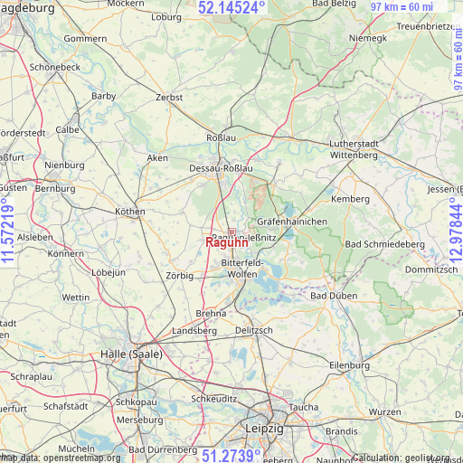
Raguhn GPS coordinates[2]
51° 42' 42.012" North, 12° 16' 31.116" East
| Map corner | latitude | longitude |
|---|---|---|
| Upper-left | 52.14524°, | 11.57219° |
| Center: | 51.71167°, | 12.27531° |
| Lower-right: | 51.2739°, | 12.97844° |
| Map W x H: | 96.9×96.9 km | = 60.2×60.2mi |
| max Lat: | 55.01917° ⇑31% North |
| Raguhn: | 51.71167° |
| min Lat: | ⇓69% South 47.40724° |
| min Long | Raguhn | max Long |
| 5.92978° | 12.27531° | 14.98853° |
| W 85.6%⇐ | ⇒14.4% E |
Elevation
Elevation of Raguhn is 73 m = 240 ft, and this is 176.1 m = 578 ft below average elevation for this country.
| Max E: |
1256 m = 4121 ft | 72.8% |
| Avg. | 249.1 m = 817 ft | |
| Raguhn | 73 m = 240 ft | |
Min E: |
-5 m = -16 ft | 27.2% |
See also: Germany elevation on elevation.city.
Geographical zone
Raguhn is located in North temperate zone (between Tropic of Cancer and the Arctic Circle). Distance of this North polar circle is 1651.4 km =1026.1 mi to North.| Distance of | km | miles | from Raguhn |
|---|---|---|---|
| North Pole | 4257.3 | 2645.4 | to North |
| Arctic Circle | 1651.4 | 1026.1 | to North |
| Tropic Cancer | 3143.9 | 1953.5 | to South |
| Equator | 5749.8 | 3572.8 | to South |


Nearby cities:
15 places around Raguhn: (largest is in red/bold)
• Bobbau
2.7 km =1.7 mi,  184°
184°
• Burgkemnitz
9.2 km =5.7 mi,  109°
109°
• Friedersdorf
9.4 km =5.8 mi,  138°
138°
• Greppin
7.4 km =4.6 mi,  166°
166°
• Hinsdorf
8.6 km =5.3 mi,  278°
278°
• Jeßnitz
3.6 km =2.2 mi,  151°
151°
• Muldenstein
6.6 km =4.1 mi,  132°
132°
• Möhlau
5.8 km =3.6 mi,  67°
67°
• Salzfurtkapelle
6.9 km =4.3 mi,  253°
253°
• Sandersdorf
9.3 km =5.8 mi, 184°
• Schierau
4.1 km =2.5 mi,  7°
7°
• Thalheim
7.3 km =4.5 mi,  206°
206°
• Tornau
6.5 km =4 mi, 276°
• Wolfen
5.6 km =3.5 mi, 184°
• Zschornewitz
8.6 km =5.3 mi,  86°
86°
Sources, notices
• [Note1] Compared only with cities in Germany existing in our database
• [Src1] Map data: © OpenStreetMap contributors (CC-BY-SA)
• [Src2] Other city data from geonames.org with taken over terms of usage.
• [Src3] Geographical zone / Annual Mean Temperature by Robert A. Rohde @ Wikipedia
