Schierau geodata
Schierau (Saxony-Anhalt) is a populated place; located in Germany in Europe/Berlin (GMT+2) time zone. With population of 846 people, there are 7722 cities with bigger population in this country. Compared to other cities in Germany, 69.3% of cities are located further ↓South; 85.7% of cities are located further ←West and 73.6% of cities have higher elevation than Schierau. Note1
Administrative division(s):
- Level 1: Saxony-Anhalt
- Level 3: Anhalt-Bitterfeld
- Level 4: Raguhn-Jeßnitz


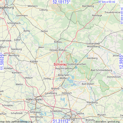
Schierau GPS coordinates[2]
51° 44' 54.708" North, 12° 17' 0.132" East
| Map corner | latitude | longitude |
|---|---|---|
| Upper-left | 52.18175°, | 11.58025° |
| Center: | 51.74853°, | 12.28337° |
| Lower-right: | 51.31112°, | 12.9865° |
| Map W x H: | 96.8×96.8 km | = 60.1×60.1mi |
| max Lat: | 55.01917° ⇑30.7% North |
| Schierau: | 51.74853° |
| min Lat: | ⇓69.3% South 47.40724° |
| min Long | Schierau | max Long |
| 5.92978° | 12.28337° | 14.98853° |
| W 85.7%⇐ | ⇒14.3% E |
Elevation
Elevation of Schierau is 69 m = 226 ft, and this is 180.1 m = 591 ft below average elevation for this country.
| Max E: |
1256 m = 4121 ft | 73.6% |
| Avg. | 249.1 m = 817 ft | |
| Schierau | 69 m = 226 ft | |
Min E: |
-5 m = -16 ft | 26.4% |
See also: Germany elevation on elevation.city.
Geographical zone
Schierau is located in North temperate zone (between Tropic of Cancer and the Arctic Circle). Distance of this North polar circle is 1647.3 km =1023.6 mi to North.| Distance of | km | miles | from Schierau |
|---|---|---|---|
| North Pole | 4253.2 | 2642.8 | to North |
| Arctic Circle | 1647.3 | 1023.6 | to North |
| Tropic Cancer | 3148 | 1956.1 | to South |
| Equator | 5753.9 | 3575.3 | to South |


Nearby cities:
15 places around Schierau: (largest is in red/bold)
• Bobbau
6.8 km =4.2 mi,  186°
186°
• Burgkemnitz
10.8 km =6.7 mi,  131°
131°
• Dessau
10.4 km =6.5 mi,  345°
345°
• Hinsdorf
9.5 km =5.9 mi,  252°
252°
• Jeßnitz
7.4 km =4.6 mi,  171°
171°
• Jüdenberg
9 km =5.6 mi,  88°
88°
• Muldenstein
9.5 km =5.9 mi,  153°
153°
• Möhlau
5.2 km =3.2 mi,  111°
111°
• Oranienbaum
10.1 km =6.3 mi,  56°
56°
• Quellendorf
10.7 km =6.6 mi,  270°
270°
• Raguhn
4.1 km =2.5 mi, 187°
• Salzfurtkapelle
9.4 km =5.8 mi,  230°
230°
• Tornau
7.8 km =4.8 mi,  244°
244°
• Wolfen
9.8 km =6.1 mi, 185°
• Zschornewitz
8.8 km =5.5 mi, 114°
Sources, notices
• [Note1] Compared only with cities in Germany existing in our database
• [Src1] Map data: © OpenStreetMap contributors (CC-BY-SA)
• [Src2] Other city data from geonames.org with taken over terms of usage.
• [Src3] Geographical zone / Annual Mean Temperature by Robert A. Rohde @ Wikipedia
