Pokrent geodata
Pokrent (Mecklenburg-Vorpommern) is a populated place; located in Germany in Europe/Berlin (GMT+2) time zone. With population of 785 people, there are 7961 cities with bigger population in this country. Compared to other cities in Germany, 87.7% of cities are located further ↓South; 69.1% of cities are located further ←West and 77.9% of cities have higher elevation than Pokrent. Note1
Administrative division(s):
- Level 1: Mecklenburg-Vorpommern
- Level 3: Nordwestmecklenburg
- Level 4: Pokrent


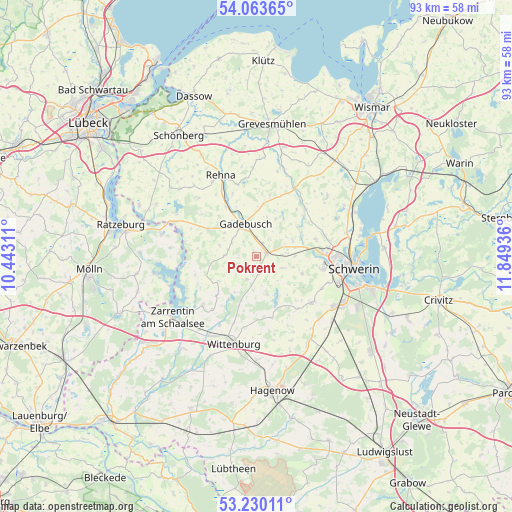
Pokrent GPS coordinates[2]
53° 38' 56.184" North, 11° 8' 46.428" East
| Map corner | latitude | longitude |
|---|---|---|
| Upper-left | 54.06365°, | 10.44311° |
| Center: | 53.64894°, | 11.14623° |
| Lower-right: | 53.23011°, | 11.84936° |
| Map W x H: | 92.7×92.7 km | = 57.6×57.6mi |
| max Lat: | 55.01917° ⇑12.3% North |
| Pokrent: | 53.64894° |
| min Lat: | ⇓87.7% South 47.40724° |
| min Long | Pokrent | max Long |
| 5.92978° | 11.14623° | 14.98853° |
| W 69.1%⇐ | ⇒30.9% E |
Elevation
Elevation of Pokrent is 53 m = 174 ft, and this is 196.1 m = 643 ft below average elevation for this country.
| Max E: |
1256 m = 4121 ft | 77.9% |
| Avg. | 249.1 m = 817 ft | |
| Pokrent | 53 m = 174 ft | |
Min E: |
-5 m = -16 ft | 22.1% |
See also: Germany elevation on elevation.city.
Geographical zone
Pokrent is located in North temperate zone (between Tropic of Cancer and the Arctic Circle). Distance of this North polar circle is 1436 km =892.3 mi to North.| Distance of | km | miles | from Pokrent |
|---|---|---|---|
| North Pole | 4041.9 | 2511.5 | to North |
| Arctic Circle | 1436 | 892.3 | to North |
| Tropic Cancer | 3359.3 | 2087.4 | to South |
| Equator | 5965.2 | 3706.6 | to South |


Nearby cities:
15 places around Pokrent: (largest is in red/bold)
• Brüsewitz
7.1 km =4.4 mi,  65°
65°
• Cramonshagen
10.5 km =6.5 mi,  53°
53°
• Dragun
8.4 km =5.2 mi,  38°
38°
• Dümmer
9 km =5.6 mi,  154°
154°
• Gadebusch
6.1 km =3.8 mi,  341°
341°
• Gottesgabe
7.1 km =4.4 mi,  106°
106°
• Klein Rogahn
14 km =8.7 mi, 110°
• Krembz
5.6 km =3.5 mi,  272°
272°
• Lützow
2 km =1.2 mi,  75°
75°
• Mühlen Eichsen
13.9 km =8.6 mi,  29°
29°
• Pingelshagen
13 km =8.1 mi, 73°
• Roggendorf
10 km =6.2 mi,  299°
299°
• Stralendorf
13.2 km =8.2 mi,  128°
128°
• Veelböken
11.4 km =7.1 mi,  12°
12°
• Wittenförden
12.3 km =7.6 mi,  100°
100°
Sources, notices
• [Note1] Compared only with cities in Germany existing in our database
• [Src1] Map data: © OpenStreetMap contributors (CC-BY-SA)
• [Src2] Other city data from geonames.org with taken over terms of usage.
• [Src3] Geographical zone / Annual Mean Temperature by Robert A. Rohde @ Wikipedia
