Dümmer geodata
Dümmer (Mecklenburg-Vorpommern) is a populated place; located in Germany in Europe/Berlin (GMT+2) time zone. With population of 1,419 people, there are 6041 cities with bigger population in this country. Compared to other cities in Germany, 86.6% of cities are located further ↓South; 70% of cities are located further ←West and 79.2% of cities have higher elevation than Dümmer. Note1
Administrative division(s):
- Level 1: Mecklenburg-Vorpommern
- Level 3: Ludwigslust-Parchim
- Level 4: Dümmer


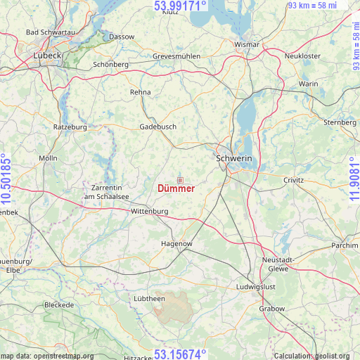
Dümmer GPS coordinates[2]
53° 34' 34.644" North, 11° 12' 17.892" East
| Map corner | latitude | longitude |
|---|---|---|
| Upper-left | 53.99171°, | 10.50185° |
| Center: | 53.57629°, | 11.20497° |
| Lower-right: | 53.15674°, | 11.9081° |
| Map W x H: | 92.8×92.8 km | = 57.7×57.7mi |
| max Lat: | 55.01917° ⇑13.4% North |
| Dümmer: | 53.57629° |
| min Lat: | ⇓86.6% South 47.40724° |
| min Long | Dümmer | max Long |
| 5.92978° | 11.20497° | 14.98853° |
| W 70%⇐ | ⇒30% E |
Elevation
Elevation of Dümmer is 49 m = 161 ft, and this is 200.1 m = 656 ft below average elevation for this country.
| Max E: |
1256 m = 4121 ft | 79.2% |
| Avg. | 249.1 m = 817 ft | |
| Dümmer | 49 m = 161 ft | |
Min E: |
-5 m = -16 ft | 20.8% |
See also: Germany elevation on elevation.city.
Geographical zone
Dümmer is located in North temperate zone (between Tropic of Cancer and the Arctic Circle). Distance of this North polar circle is 1444 km =897.3 mi to North.| Distance of | km | miles | from Dümmer |
|---|---|---|---|
| North Pole | 4049.9 | 2516.5 | to North |
| Arctic Circle | 1444 | 897.3 | to North |
| Tropic Cancer | 3351.2 | 2082.3 | to South |
| Equator | 5957.1 | 3701.6 | to South |


Nearby cities:
15 places around Dümmer: (largest is in red/bold)
• Brüsewitz
11.4 km =7.1 mi,  13°
13°
• Feldstadt
14.3 km =8.9 mi,  68°
68°
• Gottesgabe
6.8 km =4.2 mi,  25°
25°
• Holthusen
10.6 km =6.6 mi,  111°
111°
• Klein Rogahn
9.8 km =6.1 mi, 70°
• Krembz
12.6 km =7.8 mi,  311°
311°
• Lankow
13.6 km =8.5 mi,  52°
52°
• Lützow
8.8 km =5.5 mi,  347°
347°
• Neumühle
12.6 km =7.8 mi,  60°
60°
• Pokrent
9 km =5.6 mi,  334°
334°
• Stralendorf
6.5 km =4 mi,  91°
91°
• Sülstorf
13.5 km =8.4 mi,  123°
123°
• Weststadt
14.2 km =8.8 mi, 62°
• Wittenburg
11.3 km =7 mi,  226°
226°
• Wittenförden
10.1 km =6.3 mi, 54°
Sources, notices
• [Note1] Compared only with cities in Germany existing in our database
• [Src1] Map data: © OpenStreetMap contributors (CC-BY-SA)
• [Src2] Other city data from geonames.org with taken over terms of usage.
• [Src3] Geographical zone / Annual Mean Temperature by Robert A. Rohde @ Wikipedia
