Roggendorf geodata
Roggendorf (Mecklenburg-Vorpommern) is a populated place; located in Germany in Europe/Berlin (GMT+2) time zone. With population of 1,029 people, there are 7082 cities with bigger population in this country. Compared to other cities in Germany, 88.5% of cities are located further ↓South; 67.1% of cities are located further ←West and 76.1% of cities have higher elevation than Roggendorf. Note1
Administrative division(s):
- Level 1: Mecklenburg-Vorpommern
- Level 3: Nordwestmecklenburg
- Level 4: Roggendorf


Roggendorf GPS coordinates[2]
53° 41' 34.512" North, 11° 0' 51.84" East
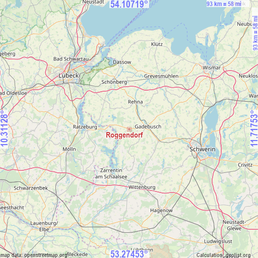
| Map corner | latitude | longitude |
|---|---|---|
| Upper-left | 54.10719°, | 10.31128° |
| Center: | 53.69292°, | 11.0144° |
| Lower-right: | 53.27453°, | 11.71753° |
| Map W x H: | 92.6×92.6 km | = 57.5×57.5mi |
| max Lat: | 55.01917° ⇑11.5% North |
| Roggendorf: | 53.69292° |
| min Lat: | ⇓88.5% South 47.40724° |
| min Long | Roggendorf | max Long |
| 5.92978° | 11.0144° | 14.98853° |
| W 67.1%⇐ | ⇒32.9% E |
Elevation
Elevation of Roggendorf is 59 m = 194 ft, and this is 190.1 m = 624 ft below average elevation for this country.
| Max E: |
1256 m = 4121 ft | 76.1% |
| Avg. | 249.1 m = 817 ft | |
| Roggendorf | 59 m = 194 ft | |
Min E: |
-5 m = -16 ft | 23.9% |
See also: Germany elevation on elevation.city.
Geographical zone
Roggendorf is located in North temperate zone (between Tropic of Cancer and the Arctic Circle). Distance of this North polar circle is 1431.1 km =889.2 mi to North.| Distance of | km | miles | from Roggendorf |
|---|---|---|---|
| North Pole | 4037 | 2508.5 | to North |
| Arctic Circle | 1431.1 | 889.2 | to North |
| Tropic Cancer | 3364.2 | 2090.4 | to South |
| Equator | 5970.1 | 3709.6 | to South |


Nearby cities:
15 places around Roggendorf: (largest is in red/bold)
• Carlow
8.9 km =5.5 mi,  325°
325°
• Dragun
14 km =8.7 mi,  83°
83°
• Gadebusch
6.8 km =4.2 mi, 82°
• Kittlitz
7.2 km =4.5 mi,  243°
243°
• Krembz
5.6 km =3.5 mi,  146°
146°
• Lützow
11.5 km =7.1 mi,  112°
112°
• Mechow
14.4 km =8.9 mi,  280°
280°
• Mustin
8.7 km =5.4 mi,  262°
262°
• Pokrent
10 km =6.2 mi,  119°
119°
• Rehna
9.8 km =6.1 mi,  13°
13°
• Salem
13.1 km =8.1 mi,  251°
251°
• Schlagsdorf
13.2 km =8.2 mi,  290°
290°
• Seedorf
12.7 km =7.9 mi,  230°
230°
• Veelböken
12.7 km =7.9 mi,  60°
60°
• Ziethen
13.5 km =8.4 mi,  270°
270°
Sources, notices
• [Note1] Compared only with cities in Germany existing in our database
• [Src1] Map data: © OpenStreetMap contributors (CC-BY-SA)
• [Src2] Other city data from geonames.org with taken over terms of usage.
• [Src3] Geographical zone / Annual Mean Temperature by Robert A. Rohde @ Wikipedia
