Veelböken geodata
Veelböken (Mecklenburg-Vorpommern) is a populated place; located in Germany in Europe/Berlin (GMT+2) time zone. With population of 791 people, there are 7937 cities with bigger population in this country. Compared to other cities in Germany, 89.3% of cities are located further ↓South; 69.7% of cities are located further ←West and 75.8% of cities have higher elevation than Veelböken. Note1
Administrative division(s):
- Level 1: Mecklenburg-Vorpommern
- Level 3: Nordwestmecklenburg
- Level 4: Veelböken


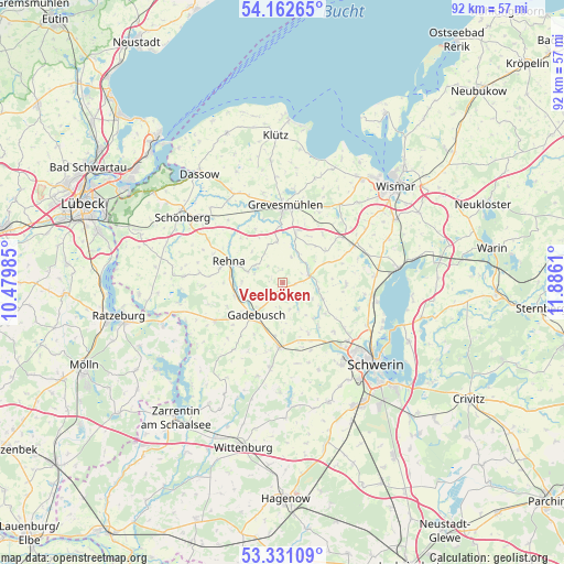
Veelböken GPS coordinates[2]
53° 44' 56.148" North, 11° 10' 58.692" East
| Map corner | latitude | longitude |
|---|---|---|
| Upper-left | 54.16265°, | 10.47985° |
| Center: | 53.74893°, | 11.18297° |
| Lower-right: | 53.33109°, | 11.8861° |
| Map W x H: | 92.5×92.5 km | = 57.5×57.5mi |
| max Lat: | 55.01917° ⇑10.7% North |
| Veelböken: | 53.74893° |
| min Lat: | ⇓89.3% South 47.40724° |
| min Long | Veelböken | max Long |
| 5.92978° | 11.18297° | 14.98853° |
| W 69.7%⇐ | ⇒30.3% E |
Elevation
Elevation of Veelböken is 60 m = 197 ft, and this is 189.1 m = 620 ft below average elevation for this country.
| Max E: |
1256 m = 4121 ft | 75.8% |
| Avg. | 249.1 m = 817 ft | |
| Veelböken | 60 m = 197 ft | |
Min E: |
-5 m = -16 ft | 24.2% |
See also: Germany elevation on elevation.city.
Geographical zone
Veelböken is located in North temperate zone (between Tropic of Cancer and the Arctic Circle). Distance of this North polar circle is 1424.9 km =885.4 mi to North.| Distance of | km | miles | from Veelböken |
|---|---|---|---|
| North Pole | 4030.7 | 2504.6 | to North |
| Arctic Circle | 1424.9 | 885.4 | to North |
| Tropic Cancer | 3370.4 | 2094.3 | to South |
| Equator | 5976.3 | 3713.5 | to South |


Nearby cities:
15 places around Veelböken: (largest is in red/bold)
• Alt Meteln
10.4 km =6.5 mi,  91°
91°
• Brüsewitz
9.1 km =5.7 mi,  153°
153°
• Cramonshagen
7.7 km =4.8 mi,  128°
128°
• Dragun
5.3 km =3.3 mi, 148°
• Gadebusch
6.9 km =4.3 mi,  219°
219°
• Groß Krankow
12.5 km =7.8 mi,  53°
53°
• Lützow
10.6 km =6.6 mi,  182°
182°
• Mühlen Eichsen
4.5 km =2.8 mi,  77°
77°
• Pingelshagen
12.4 km =7.7 mi, 126°
• Plüschow
11.2 km =7 mi,  30°
30°
• Pokrent
11.4 km =7.1 mi,  192°
192°
• Rehna
9.4 km =5.8 mi,  290°
290°
• Rüting
5.6 km =3.5 mi, 26°
• Testorf-Steinfort
6.5 km =4 mi,  61°
61°
• Upahl
8.2 km =5.1 mi,  15°
15°
Sources, notices
• [Note1] Compared only with cities in Germany existing in our database
• [Src1] Map data: © OpenStreetMap contributors (CC-BY-SA)
• [Src2] Other city data from geonames.org with taken over terms of usage.
• [Src3] Geographical zone / Annual Mean Temperature by Robert A. Rohde @ Wikipedia
