Pfalzgrafenweiler geodata
Pfalzgrafenweiler (Baden-Württemberg) is a seat of a fourth-order administrative division; located in Germany in Europe/Berlin (GMT+2) time zone. With population of 7,038 people, there are 2174 cities with bigger population in this country. Compared to other cities in Germany, 88.8% of cities are located further ↑North; 70.5% of cities are located further →East and 96.2% of cities have lower elevation than Pfalzgrafenweiler. Note1
Administrative division(s):
- Level 1: Baden-Württemberg
- Level 2: Karlsruhe Region
- Level 3: Landkreis Freudenstadt
- Level 4: Pfalzgrafenweiler


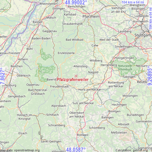
Pfalzgrafenweiler GPS coordinates[2]
48° 31' 35.4" North, 8° 33' 56.952" East
| Map corner | latitude | longitude |
|---|---|---|
| Upper-left | 48.99002°, | 7.8627° |
| Center: | 48.5265°, | 8.56582° |
| Lower-right: | 48.0587°, | 9.26895° |
| Map W x H: | 103.6×103.6 km | = 64.4×64.4mi |
| max Lat: | 55.01917° ⇑88.8% North |
| Pfalzgrafenweiler: | 48.5265° |
| min Lat: | ⇓11.2% South 47.40724° |
| min Long | Pfalzgrafenweil | max Long |
| 5.92978° | 8.56582° | 14.98853° |
| W 29.5%⇐ | ⇒70.5% E |
Elevation
Elevation of Pfalzgrafenweiler is 634 m = 2080 ft, and this is 384.9 m = 1263 ft above average elevation for this country.
| Max E: |
1256 m = 4121 ft | 3.8% |
| Pfalzgrafenweiler | 634 m 2080 ft | |
| Avg. | 249.1 m = 817 ft | |
Min E: |
-5 m = -16 ft | 96.2% |
See also: Germany elevation on elevation.city.
Geographical zone
Pfalzgrafenweiler is located in North temperate zone (between Tropic of Cancer and the Arctic Circle). Distance of this North polar circle is 2005.5 km =1246.2 mi to North.| Distance of | km | miles | from Pfalzgrafenweiler |
|---|---|---|---|
| North Pole | 4611.4 | 2865.4 | to North |
| Arctic Circle | 2005.5 | 1246.2 | to North |
| Tropic Cancer | 2789.7 | 1733.4 | to South |
| Equator | 5395.6 | 3352.7 | to South |


Nearby cities:
15 places around Pfalzgrafenweiler: (largest is in red/bold)
• Altensteig
7.2 km =4.5 mi,  22°
22°
• Baiersbronn
14.1 km =8.8 mi,  259°
259°
• Dornstetten
7.8 km =4.8 mi,  219°
219°
• Ebhausen
10.7 km =6.6 mi,  53°
53°
• Egenhausen
5.8 km =3.6 mi,  39°
39°
• Freudenstadt
13 km =8.1 mi,  239°
239°
• Glatten
10.2 km =6.3 mi,  203°
203°
• Grömbach
5.4 km =3.4 mi,  343°
343°
• Haiterbach
5.8 km =3.6 mi,  96°
96°
• Horb am Neckar
13 km =8.1 mi,  134°
134°
• Nagold
11.9 km =7.4 mi,  77°
77°
• Rohrdorf
10.8 km =6.7 mi,  65°
65°
• Schopfloch
8 km =5 mi,  187°
187°
• Simmersfeld
10.7 km =6.6 mi, 340°
• Wörnersberg
4.5 km =2.8 mi,  0°
0°
Sources, notices
• [Note1] Compared only with cities in Germany existing in our database
• [Src1] Map data: © OpenStreetMap contributors (CC-BY-SA)
• [Src2] Other city data from geonames.org with taken over terms of usage.
• [Src3] Geographical zone / Annual Mean Temperature by Robert A. Rohde @ Wikipedia
