Otterbach geodata
Otterbach (Rheinland-Pfalz) is a seat of a fourth-order administrative division; located in Germany in Europe/Berlin (GMT+2) time zone. With population of 4,087 people, there are 3244 cities with bigger population in this country. Compared to other cities in Germany, 75.9% of cities are located further ↑North; 82.3% of cities are located further →East and 50.4% of cities have higher elevation than Otterbach. Note1
Administrative division(s):
- Level 1: Rheinland-Pfalz
- Level 3: Landkreis Kaiserslautern
- Level 4: Otterbach


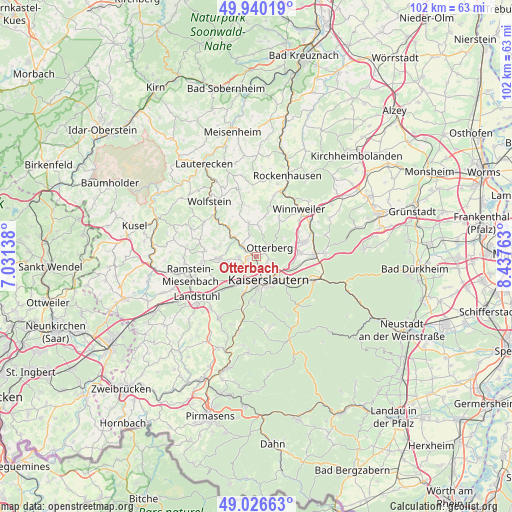
Otterbach GPS coordinates[2]
49° 29' 7.944" North, 7° 44' 4.2" East
| Map corner | latitude | longitude |
|---|---|---|
| Upper-left | 49.94019°, | 7.03138° |
| Center: | 49.48554°, | 7.7345° |
| Lower-right: | 49.02663°, | 8.43763° |
| Map W x H: | 101.6×101.6 km | = 63.1×63.1mi |
| max Lat: | 55.01917° ⇑75.9% North |
| Otterbach: | 49.48554° |
| min Lat: | ⇓24.1% South 47.40724° |
| min Long | Otterbach | max Long |
| 5.92978° | 7.7345° | 14.98853° |
| W 17.7%⇐ | ⇒82.3% E |
Elevation
Elevation of Otterbach is 222 m = 728 ft, and this is 27.1 m = 89 ft below average elevation for this country.
| Max E: |
1256 m = 4121 ft | 50.4% |
| Avg. | 249.1 m = 817 ft | |
| Otterbach | 222 m = 728 ft | |
Min E: |
-5 m = -16 ft | 49.6% |
See also: Germany elevation on elevation.city.
Geographical zone
Otterbach is located in North temperate zone (between Tropic of Cancer and the Arctic Circle). Distance of this North polar circle is 1898.9 km =1179.9 mi to North.| Distance of | km | miles | from Otterbach |
|---|---|---|---|
| North Pole | 4504.8 | 2799.2 | to North |
| Arctic Circle | 1898.9 | 1179.9 | to North |
| Tropic Cancer | 2896.4 | 1799.7 | to South |
| Equator | 5502.3 | 3419 | to South |


Nearby cities:
15 places around Otterbach: (largest is in red/bold)
• Erzenhausen
8.7 km =5.4 mi,  280°
280°
• Eulenbis
7.5 km =4.7 mi, 282°
• Heiligenmoschel
7.5 km =4.7 mi,  17°
17°
• Hirschhorn
5.5 km =3.4 mi,  313°
313°
• Höringen
9 km =5.6 mi,  29°
29°
• Kaiserslautern
5.4 km =3.4 mi,  150°
150°
• Katzweiler
3 km =1.9 mi,  302°
302°
• Mehlbach
3.7 km =2.3 mi,  339°
339°
• Mehlingen
8.7 km =5.4 mi,  85°
85°
• Olsbrücken
8.1 km =5 mi,  317°
317°
• Otterberg
3.2 km =2 mi,  52°
52°
• Rodenbach
5.7 km =3.5 mi,  255°
255°
• Schallodenbach
7.3 km =4.5 mi,  349°
349°
• Schneckenhausen
5.9 km =3.7 mi,  7°
7°
• Weilerbach
7.3 km =4.5 mi,  268°
268°
Sources, notices
• [Note1] Compared only with cities in Germany existing in our database
• [Src1] Map data: © OpenStreetMap contributors (CC-BY-SA)
• [Src2] Other city data from geonames.org with taken over terms of usage.
• [Src3] Geographical zone / Annual Mean Temperature by Robert A. Rohde @ Wikipedia
