Otterberg geodata
Otterberg (Rheinland-Pfalz) is a populated place; located in Germany in Europe/Berlin (GMT+2) time zone. With population of 5,215 people, there are 2728 cities with bigger population in this country. Compared to other cities in Germany, 75.7% of cities are located further ↑North; 81.6% of cities are located further →East and 55.7% of cities have lower elevation than Otterberg. Note1
Administrative division(s):
- Level 1: Rheinland-Pfalz
- Level 3: Landkreis Kaiserslautern
- Level 4: Otterberg


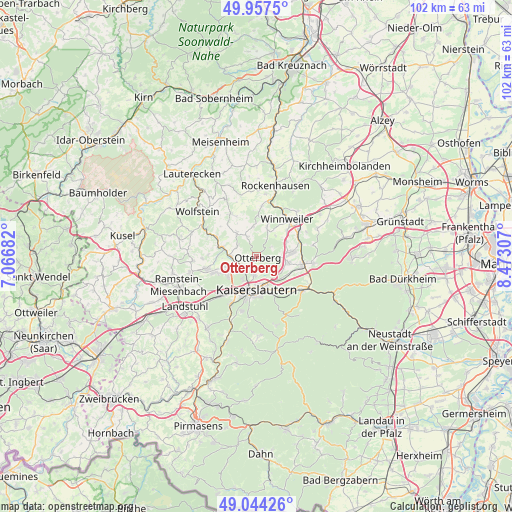
Otterberg GPS coordinates[2]
49° 30' 10.836" North, 7° 46' 11.82" East
| Map corner | latitude | longitude |
|---|---|---|
| Upper-left | 49.9575°, | 7.06682° |
| Center: | 49.50301°, | 7.76995° |
| Lower-right: | 49.04426°, | 8.47307° |
| Map W x H: | 101.5×101.5 km | = 63.1×63.1mi |
| max Lat: | 55.01917° ⇑75.7% North |
| Otterberg: | 49.50301° |
| min Lat: | ⇓24.3% South 47.40724° |
| min Long | Otterberg | max Long |
| 5.92978° | 7.76995° | 14.98853° |
| W 18.4%⇐ | ⇒81.6% E |
Elevation
Elevation of Otterberg is 263 m = 863 ft, and this is 13.9 m = 46 ft above average elevation for this country.
| Max E: |
1256 m = 4121 ft | 44.3% |
| Otterberg | 263 m 863 ft | |
| Avg. | 249.1 m = 817 ft | |
Min E: |
-5 m = -16 ft | 55.7% |
See also: Germany elevation on elevation.city.
Geographical zone
Otterberg is located in North temperate zone (between Tropic of Cancer and the Arctic Circle). Distance of this North polar circle is 1897 km =1178.7 mi to North.| Distance of | km | miles | from Otterberg |
|---|---|---|---|
| North Pole | 4502.8 | 2797.9 | to North |
| Arctic Circle | 1897 | 1178.7 | to North |
| Tropic Cancer | 2898.3 | 1800.9 | to South |
| Equator | 5504.2 | 3420.2 | to South |


Nearby cities:
15 places around Otterberg: (largest is in red/bold)
• Gehrweiler
8.9 km =5.5 mi,  358°
358°
• Heiligenmoschel
5.2 km =3.2 mi, 357°
• Hirschhorn
6.8 km =4.2 mi,  285°
285°
• Höringen
6.1 km =3.8 mi,  17°
17°
• Kaiserslautern
6.7 km =4.2 mi,  178°
178°
• Katzweiler
5.1 km =3.2 mi,  266°
266°
• Lohnsfeld
7.8 km =4.8 mi,  47°
47°
• Mehlbach
4.1 km =2.5 mi, 291°
• Mehlingen
6.3 km =3.9 mi,  101°
101°
• Otterbach
3.2 km =2 mi,  232°
232°
• Rodenbach
8.8 km =5.5 mi,  247°
247°
• Schallodenbach
6.5 km =4 mi,  323°
323°
• Schneckenhausen
4.3 km =2.7 mi,  335°
335°
• Sembach
7 km =4.3 mi,  82°
82°
• Wartenberg-Rohrbach
6.6 km =4.1 mi,  65°
65°
Sources, notices
• [Note1] Compared only with cities in Germany existing in our database
• [Src1] Map data: © OpenStreetMap contributors (CC-BY-SA)
• [Src2] Other city data from geonames.org with taken over terms of usage.
• [Src3] Geographical zone / Annual Mean Temperature by Robert A. Rohde @ Wikipedia
