Katzweiler geodata
Katzweiler (Rheinland-Pfalz) is a seat of a fourth-order administrative division; located in Germany in Europe/Berlin (GMT+2) time zone. With population of 1,727 people, there are 5463 cities with bigger population in this country. Compared to other cities in Germany, 75.7% of cities are located further ↑North; 83.1% of cities are located further →East and 51.5% of cities have higher elevation than Katzweiler. Note1
Administrative division(s):
- Level 1: Rheinland-Pfalz
- Level 3: Landkreis Kaiserslautern
- Level 4: Katzweiler


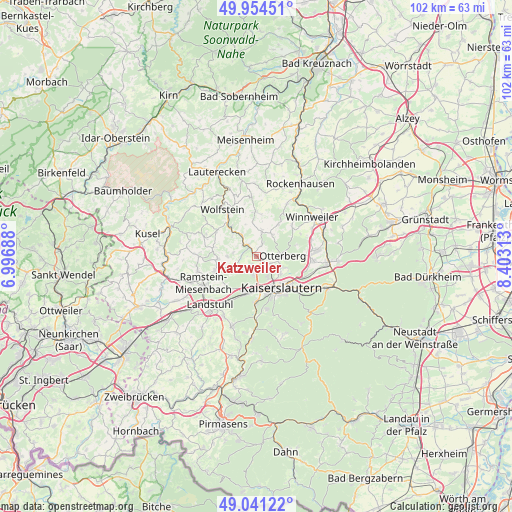
Katzweiler GPS coordinates[2]
49° 30' 0" North, 7° 42' 0" East
| Map corner | latitude | longitude |
|---|---|---|
| Upper-left | 49.95451°, | 6.99688° |
| Center: | 49.5°, | 7.7° |
| Lower-right: | 49.04122°, | 8.40313° |
| Map W x H: | 101.5×101.5 km | = 63.1×63.1mi |
| max Lat: | 55.01917° ⇑75.7% North |
| Katzweiler: | 49.5° |
| min Lat: | ⇓24.3% South 47.40724° |
| min Long | Katzweiler | max Long |
| 5.92978° | 7.7° | 14.98853° |
| W 16.9%⇐ | ⇒83.1% E |
Elevation
Elevation of Katzweiler is 215 m = 705 ft, and this is 34.1 m = 112 ft below average elevation for this country.
| Max E: |
1256 m = 4121 ft | 51.5% |
| Avg. | 249.1 m = 817 ft | |
| Katzweiler | 215 m = 705 ft | |
Min E: |
-5 m = -16 ft | 48.5% |
See also: Germany elevation on elevation.city.
Geographical zone
Katzweiler is located in North temperate zone (between Tropic of Cancer and the Arctic Circle). Distance of this North polar circle is 1897.3 km =1178.9 mi to North.| Distance of | km | miles | from Katzweiler |
|---|---|---|---|
| North Pole | 4503.2 | 2798.2 | to North |
| Arctic Circle | 1897.3 | 1178.9 | to North |
| Tropic Cancer | 2898 | 1800.7 | to South |
| Equator | 5503.9 | 3420 | to South |


Nearby cities:
15 places around Katzweiler: (largest is in red/bold)
• Erzenhausen
6 km =3.7 mi,  270°
270°
• Eulenbis
4.8 km =3 mi, 270°
• Frankelbach
6.1 km =3.8 mi,  307°
307°
• Heiligenmoschel
7.4 km =4.6 mi,  40°
40°
• Hirschhorn
2.7 km =1.7 mi,  325°
325°
• Kreimbach-Kaulbach
7.4 km =4.6 mi,  319°
319°
• Mehlbach
2.2 km =1.4 mi,  32°
32°
• Olsbrücken
5.3 km =3.3 mi, 325°
• Otterbach
3 km =1.9 mi,  122°
122°
• Otterberg
5.1 km =3.2 mi,  86°
86°
• Rodenbach
4.3 km =2.7 mi,  225°
225°
• Schallodenbach
5.7 km =3.5 mi,  12°
12°
• Schneckenhausen
5.3 km =3.3 mi, 37°
• Schwedelbach
7.7 km =4.8 mi, 266°
• Weilerbach
5.2 km =3.2 mi,  248°
248°
Sources, notices
• [Note1] Compared only with cities in Germany existing in our database
• [Src1] Map data: © OpenStreetMap contributors (CC-BY-SA)
• [Src2] Other city data from geonames.org with taken over terms of usage.
• [Src3] Geographical zone / Annual Mean Temperature by Robert A. Rohde @ Wikipedia
