Oebisfelde geodata
Oebisfelde (Saxony-Anhalt) is a populated place; located in Germany in Europe/Berlin (GMT+2) time zone. With population of 7,341 people, there are 2105 cities with bigger population in this country. Compared to other cities in Germany, 76.7% of cities are located further ↓South; 66.8% of cities are located further ←West and 75% of cities have higher elevation than Oebisfelde. Note1


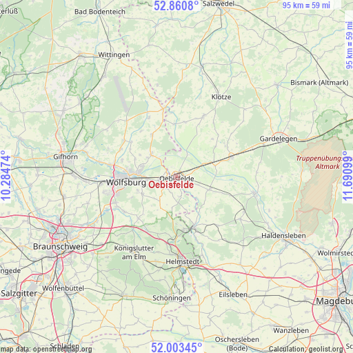
Oebisfelde GPS coordinates[2]
52° 26' 3.156" North, 10° 59' 16.296" East
| Map corner | latitude | longitude |
|---|---|---|
| Upper-left | 52.8608°, | 10.28474° |
| Center: | 52.43421°, | 10.98786° |
| Lower-right: | 52.00345°, | 11.69099° |
| Map W x H: | 95.3×95.3 km | = 59.2×59.2mi |
| max Lat: | 55.01917° ⇑23.3% North |
| Oebisfelde: | 52.43421° |
| min Lat: | ⇓76.7% South 47.40724° |
| min Long | Oebisfelde | max Long |
| 5.92978° | 10.98786° | 14.98853° |
| W 66.8%⇐ | ⇒33.2% E |
Elevation
Elevation of Oebisfelde is 63 m = 207 ft, and this is 186.1 m = 611 ft below average elevation for this country.
| Max E: |
1256 m = 4121 ft | 75% |
| Avg. | 249.1 m = 817 ft | |
| Oebisfelde | 63 m = 207 ft | |
Min E: |
-5 m = -16 ft | 25% |
See also: Germany elevation on elevation.city.
Geographical zone
Oebisfelde is located in North temperate zone (between Tropic of Cancer and the Arctic Circle). Distance of this North polar circle is 1571 km =976.2 mi to North.| Distance of | km | miles | from Oebisfelde |
|---|---|---|---|
| North Pole | 4176.9 | 2595.4 | to North |
| Arctic Circle | 1571 | 976.2 | to North |
| Tropic Cancer | 3224.2 | 2003.4 | to South |
| Equator | 5830.1 | 3622.7 | to South |


Nearby cities:
15 places around Oebisfelde: (largest is in red/bold)
• Bahrdorf
5.4 km =3.4 mi,  171°
171°
• Danndorf
5.2 km =3.2 mi,  258°
258°
• Etingen
13.2 km =8.2 mi,  109°
109°
• Grafhorst
3.1 km =1.9 mi,  292°
292°
• Grasleben
14.3 km =8.9 mi, 172°
• Groß Twülpstedt
8.2 km =5.1 mi,  214°
214°
• Jahrstedt
14 km =8.7 mi,  356°
356°
• Miesterhorst
10.8 km =6.7 mi,  74°
74°
• Parsau
13 km =8.1 mi,  329°
329°
• Querenhorst
11.3 km =7 mi,  187°
187°
• Rothenfelde
13.2 km =8.2 mi,  266°
266°
• Rätzlingen
9.3 km =5.8 mi, 113°
• Rühen
8.9 km =5.5 mi,  309°
309°
• Velpke
4.6 km =2.9 mi,  230°
230°
• Wolfsburg
14 km =8.7 mi, 265°
Sources, notices
• [Note1] Compared only with cities in Germany existing in our database
• [Src1] Map data: © OpenStreetMap contributors (CC-BY-SA)
• [Src2] Other city data from geonames.org with taken over terms of usage.
• [Src3] Geographical zone / Annual Mean Temperature by Robert A. Rohde @ Wikipedia
