Rätzlingen geodata
Rätzlingen (Saxony-Anhalt) is a populated place; located in Germany in Europe/Berlin (GMT+2) time zone. With population of 835 people, there are 7757 cities with bigger population in this country. Compared to other cities in Germany, 76.2% of cities are located further ↓South; 68.6% of cities are located further ←West and 72.1% of cities have higher elevation than Rätzlingen. Note1


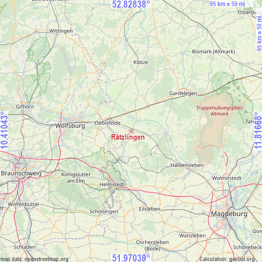
Rätzlingen GPS coordinates[2]
52° 24' 5.292" North, 11° 6' 48.78" East
| Map corner | latitude | longitude |
|---|---|---|
| Upper-left | 52.82838°, | 10.41043° |
| Center: | 52.40147°, | 11.11355° |
| Lower-right: | 51.97039°, | 11.81668° |
| Map W x H: | 95.4×95.4 km | = 59.3×59.3mi |
| max Lat: | 55.01917° ⇑23.8% North |
| Rätzlingen: | 52.40147° |
| min Lat: | ⇓76.2% South 47.40724° |
| min Long | Rätzlingen | max Long |
| 5.92978° | 11.11355° | 14.98853° |
| W 68.6%⇐ | ⇒31.4% E |
Elevation
Elevation of Rätzlingen is 77 m = 253 ft, and this is 172.1 m = 565 ft below average elevation for this country.
| Max E: |
1256 m = 4121 ft | 72.1% |
| Avg. | 249.1 m = 817 ft | |
| Rätzlingen | 77 m = 253 ft | |
Min E: |
-5 m = -16 ft | 27.9% |
See also: Germany elevation on elevation.city.
Geographical zone
Rätzlingen is located in North temperate zone (between Tropic of Cancer and the Arctic Circle). Distance of this North polar circle is 1574.7 km =978.5 mi to North.| Distance of | km | miles | from Rätzlingen |
|---|---|---|---|
| North Pole | 4180.6 | 2597.7 | to North |
| Arctic Circle | 1574.7 | 978.5 | to North |
| Tropic Cancer | 3220.6 | 2001.2 | to South |
| Equator | 5826.5 | 3620.4 | to South |


Nearby cities:
15 places around Rätzlingen: (largest is in red/bold)
• Bahrdorf
7.9 km =4.9 mi,  257°
257°
• Behnsdorf
9.9 km =6.2 mi,  164°
164°
• Calvörde
12.3 km =7.6 mi,  93°
93°
• Etingen
3.9 km =2.4 mi,  102°
102°
• Flechtingen
11.7 km =7.3 mi,  132°
132°
• Grafhorst
12.4 km =7.7 mi,  292°
292°
• Grasleben
12.5 km =7.8 mi,  212°
212°
• Groß Twülpstedt
13.5 km =8.4 mi, 256°
• Mieste
11 km =6.8 mi,  35°
35°
• Miesterhorst
6.8 km =4.2 mi,  15°
15°
• Oebisfelde
9.3 km =5.8 mi, 293°
• Querenhorst
12.5 km =7.8 mi,  232°
232°
• Siestedt
9.4 km =5.8 mi,  189°
189°
• Velpke
12 km =7.5 mi,  273°
273°
• Weferlingen
10.6 km =6.6 mi,  200°
200°
Sources, notices
• [Note1] Compared only with cities in Germany existing in our database
• [Src1] Map data: © OpenStreetMap contributors (CC-BY-SA)
• [Src2] Other city data from geonames.org with taken over terms of usage.
• [Src3] Geographical zone / Annual Mean Temperature by Robert A. Rohde @ Wikipedia
