Ockenheim geodata
Ockenheim (Rheinland-Pfalz) is a seat of a fourth-order administrative division; located in Germany in Europe/Berlin (GMT+2) time zone. With population of 2,295 people, there are 4681 cities with bigger population in this country. Compared to other cities in Germany, 65.3% of cities are located further ↑North; 77.6% of cities are located further →East and 65.6% of cities have higher elevation than Ockenheim. Note1
Administrative division(s):
- Level 1: Rheinland-Pfalz
- Level 3: Landkreis Mainz-Bingen
- Level 4: Ockenheim


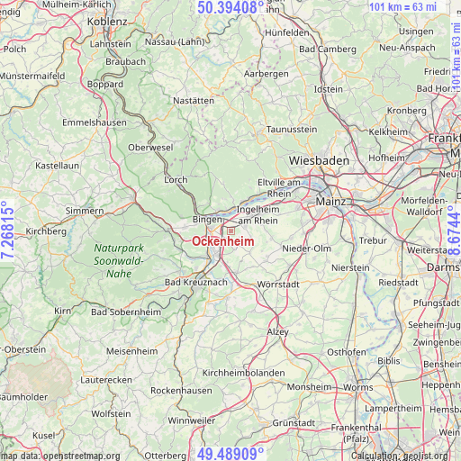
Ockenheim GPS coordinates[2]
49° 56' 37.356" North, 7° 58' 16.572" East
| Map corner | latitude | longitude |
|---|---|---|
| Upper-left | 50.39408°, | 7.26815° |
| Center: | 49.94371°, | 7.97127° |
| Lower-right: | 49.48909°, | 8.6744° |
| Map W x H: | 100.6×100.6 km | = 62.5×62.5mi |
| max Lat: | 55.01917° ⇑65.3% North |
| Ockenheim: | 49.94371° |
| min Lat: | ⇓34.7% South 47.40724° |
| min Long | Ockenheim | max Long |
| 5.92978° | 7.97127° | 14.98853° |
| W 22.4%⇐ | ⇒77.6% E |
Elevation
Elevation of Ockenheim is 117 m = 384 ft, and this is 132.1 m = 433 ft below average elevation for this country.
| Max E: |
1256 m = 4121 ft | 65.6% |
| Avg. | 249.1 m = 817 ft | |
| Ockenheim | 117 m = 384 ft | |
Min E: |
-5 m = -16 ft | 34.4% |
See also: Germany elevation on elevation.city.
Geographical zone
Ockenheim is located in North temperate zone (between Tropic of Cancer and the Arctic Circle). Distance of this North polar circle is 1848 km =1148.3 mi to North.| Distance of | km | miles | from Ockenheim |
|---|---|---|---|
| North Pole | 4453.8 | 2767.5 | to North |
| Arctic Circle | 1848 | 1148.3 | to North |
| Tropic Cancer | 2947.3 | 1831.4 | to South |
| Equator | 5553.2 | 3450.6 | to South |


Nearby cities:
15 places around Ockenheim: (largest is in red/bold)
• Appenheim
4.7 km =2.9 mi,  108°
108°
• Aspisheim
4.9 km =3 mi,  169°
169°
• Bingen am Rhein
5.8 km =3.6 mi,  296°
296°
• Gau-Algesheim
3.5 km =2.2 mi,  65°
65°
• Geisenheim
4.6 km =2.9 mi,  357°
357°
• Gensingen
5.6 km =3.5 mi,  209°
209°
• Grolsheim
5.6 km =3.5 mi,  225°
225°
• Horrweiler
4.9 km =3 mi,  183°
183°
• Ingelheim am Rhein
6.9 km =4.3 mi,  64°
64°
• Laubenheim
5.9 km =3.7 mi,  239°
239°
• Münster-Sarmsheim
5.5 km =3.4 mi,  269°
269°
• Nieder-Hilbersheim
6.1 km =3.8 mi,  123°
123°
• Ober-Hilbersheim
6.4 km =4 mi,  139°
139°
• Rüdesheim am Rhein
5.2 km =3.2 mi,  319°
319°
• Welgesheim
6.7 km =4.2 mi, 182°
Sources, notices
• [Note1] Compared only with cities in Germany existing in our database
• [Src1] Map data: © OpenStreetMap contributors (CC-BY-SA)
• [Src2] Other city data from geonames.org with taken over terms of usage.
• [Src3] Geographical zone / Annual Mean Temperature by Robert A. Rohde @ Wikipedia
