Ingelheim am Rhein geodata
Ingelheim am Rhein (Rheinland-Pfalz) is a seat of a third-order administrative division; located in Germany in Europe/Berlin (GMT+2) time zone. With population of 24,998 people, there are 590 cities with bigger population in this country. Compared to other cities in Germany, 64.5% of cities are located further ↑North; 76.1% of cities are located further →East and 66.2% of cities have higher elevation than Ingelheim am Rhein. Note1
Administrative division(s):
- Level 1: Rheinland-Pfalz
- Level 3: Landkreis Mainz-Bingen
- Level 4: Ingelheim am Rhein


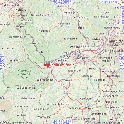
Ingelheim am Rhein GPS coordinates[2]
49° 58' 14.808" North, 8° 3' 31.788" East
| Map corner | latitude | longitude |
|---|---|---|
| Upper-left | 50.42089°, | 7.35571° |
| Center: | 49.97078°, | 8.05883° |
| Lower-right: | 49.51642°, | 8.76196° |
| Map W x H: | 100.6×100.6 km | = 62.5×62.5mi |
| max Lat: | 55.01917° ⇑64.5% North |
| Ingelheim am Rhein: | 49.97078° |
| min Lat: | ⇓35.5% South 47.40724° |
| min Long | Ingelheim am Rh | max Long |
| 5.92978° | 8.05883° | 14.98853° |
| W 23.9%⇐ | ⇒76.1% E |
Elevation
Elevation of Ingelheim am Rhein is 113 m = 371 ft, and this is 136.1 m = 447 ft below average elevation for this country.
| Max E: |
1256 m = 4121 ft | 66.2% |
| Avg. | 249.1 m = 817 ft | |
| Ingelheim am Rhein | 113 m = 371 ft | |
Min E: |
-5 m = -16 ft | 33.8% |
See also: Germany elevation on elevation.city.
Geographical zone
Ingelheim am Rhein is located in North temperate zone (between Tropic of Cancer and the Arctic Circle). Distance of this North polar circle is 1844.9 km =1146.4 mi to North.| Distance of | km | miles | from Ingelheim am Rhein |
|---|---|---|---|
| North Pole | 4450.8 | 2765.6 | to North |
| Arctic Circle | 1844.9 | 1146.4 | to North |
| Tropic Cancer | 2950.3 | 1833.2 | to South |
| Equator | 5556.2 | 3452.5 | to South |


Nearby cities:
15 places around Ingelheim am Rhein: (largest is in red/bold)
• Appenheim
4.9 km =3 mi,  201°
201°
• Bubenheim
5.7 km =3.5 mi,  164°
164°
• Eltville
7.7 km =4.8 mi,  33°
33°
• Engelstadt
7.4 km =4.6 mi,  176°
176°
• Essenheim
8.2 km =5.1 mi,  122°
122°
• Gau-Algesheim
3.5 km =2.2 mi,  243°
243°
• Geisenheim
6.7 km =4.2 mi,  283°
283°
• Kiedrich
7.9 km =4.9 mi,  13°
13°
• Nieder-Hilbersheim
6.5 km =4 mi,  190°
190°
• Nieder-Ingelheim
1.2 km =0.7 mi,  52°
52°
• Ober-Hilbersheim
8.2 km =5.1 mi, 195°
• Ockenheim
6.9 km =4.3 mi, 244°
• Schwabenheim
5.3 km =3.3 mi,  150°
150°
• Stadecken-Elsheim
8.1 km =5 mi,  143°
143°
• Wackernheim
4.2 km =2.6 mi,  84°
84°
Sources, notices
• [Note1] Compared only with cities in Germany existing in our database
• [Src1] Map data: © OpenStreetMap contributors (CC-BY-SA)
• [Src2] Other city data from geonames.org with taken over terms of usage.
• [Src3] Geographical zone / Annual Mean Temperature by Robert A. Rohde @ Wikipedia
